Maps
34 sheets
Every map here was drawn for this guide by one program, from open data, at three scales: the region, the ridge, and the ground around the waypoint. Open a sheet to pan and zoom, download it to print, see it over the ground in the explorer, or drape it over the ridge in 3D.
Topographic
The working maps. Contours, streams, roads, the UTM grid and ground cover as a quiet tint. These are the ones to print.

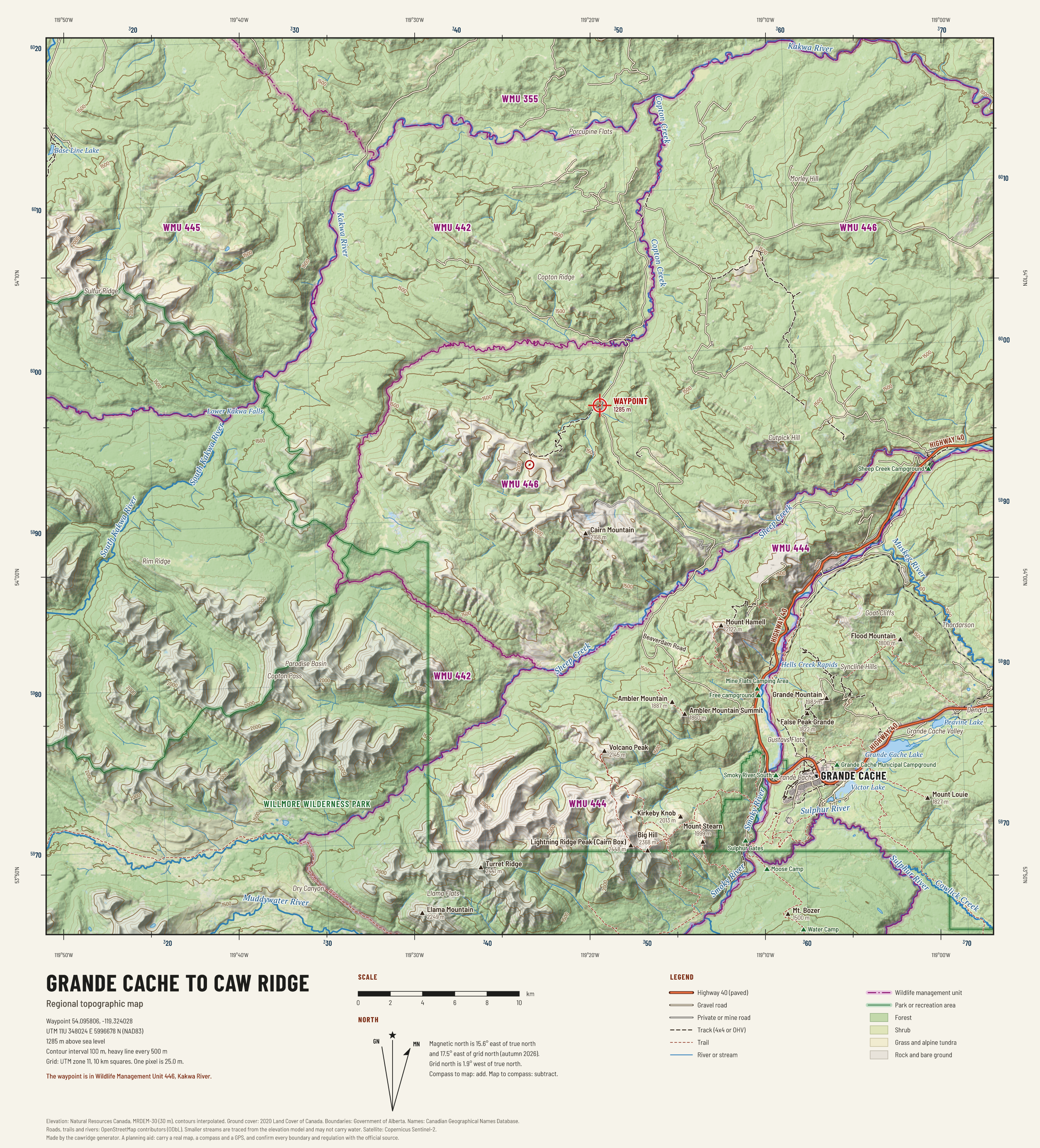
Region: Grande Cache to Caw Ridge
The whole approach on one sheet: Highway 40, Beaverdam Road, the ridge, the parks and the wildlife management units. Contours every 100 m.

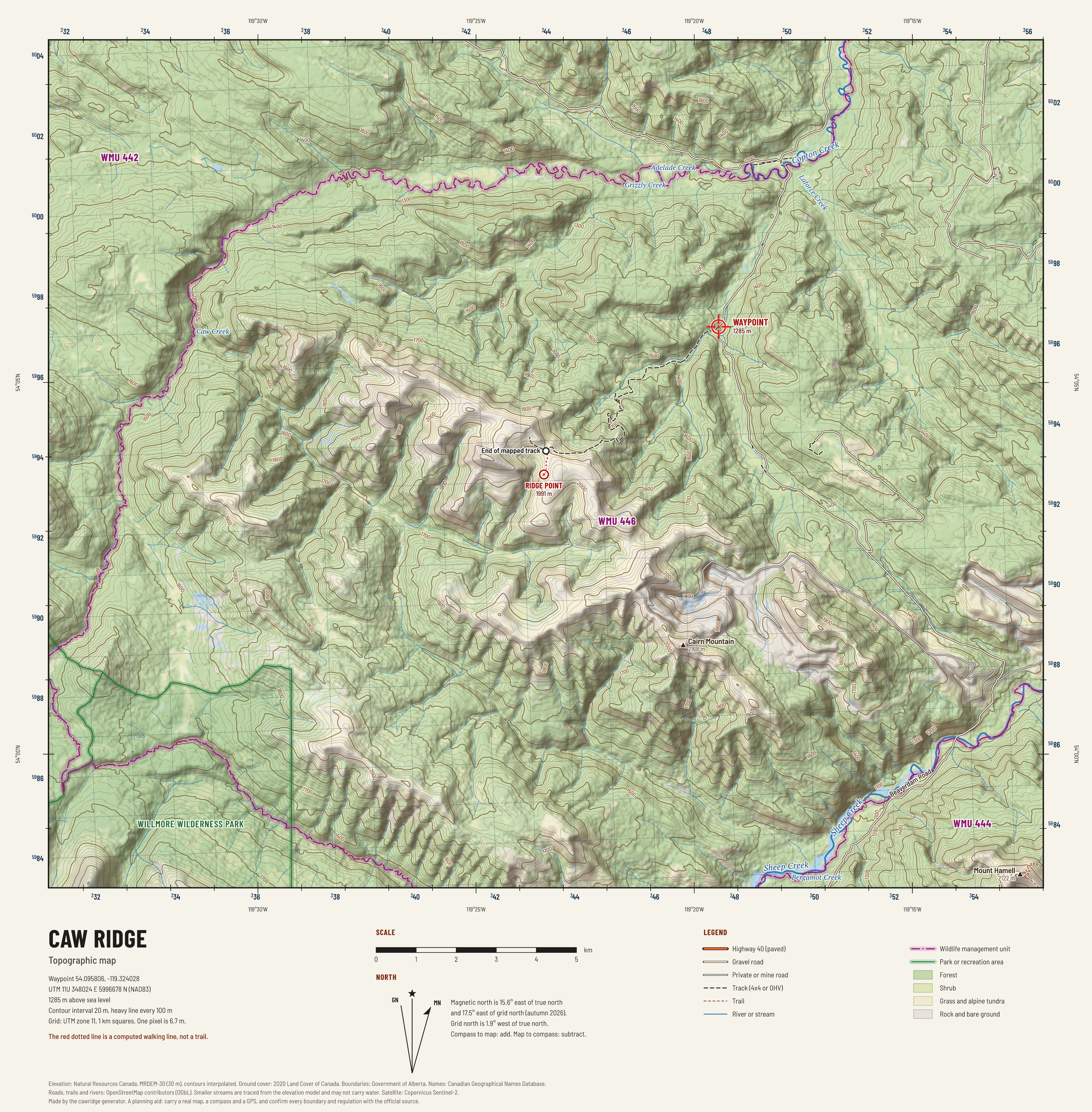
Caw Ridge
The ridge and the roads that reach it, with 20 m contours, a 1 km UTM grid, streams traced from the elevation model and the ground cover as a tint.

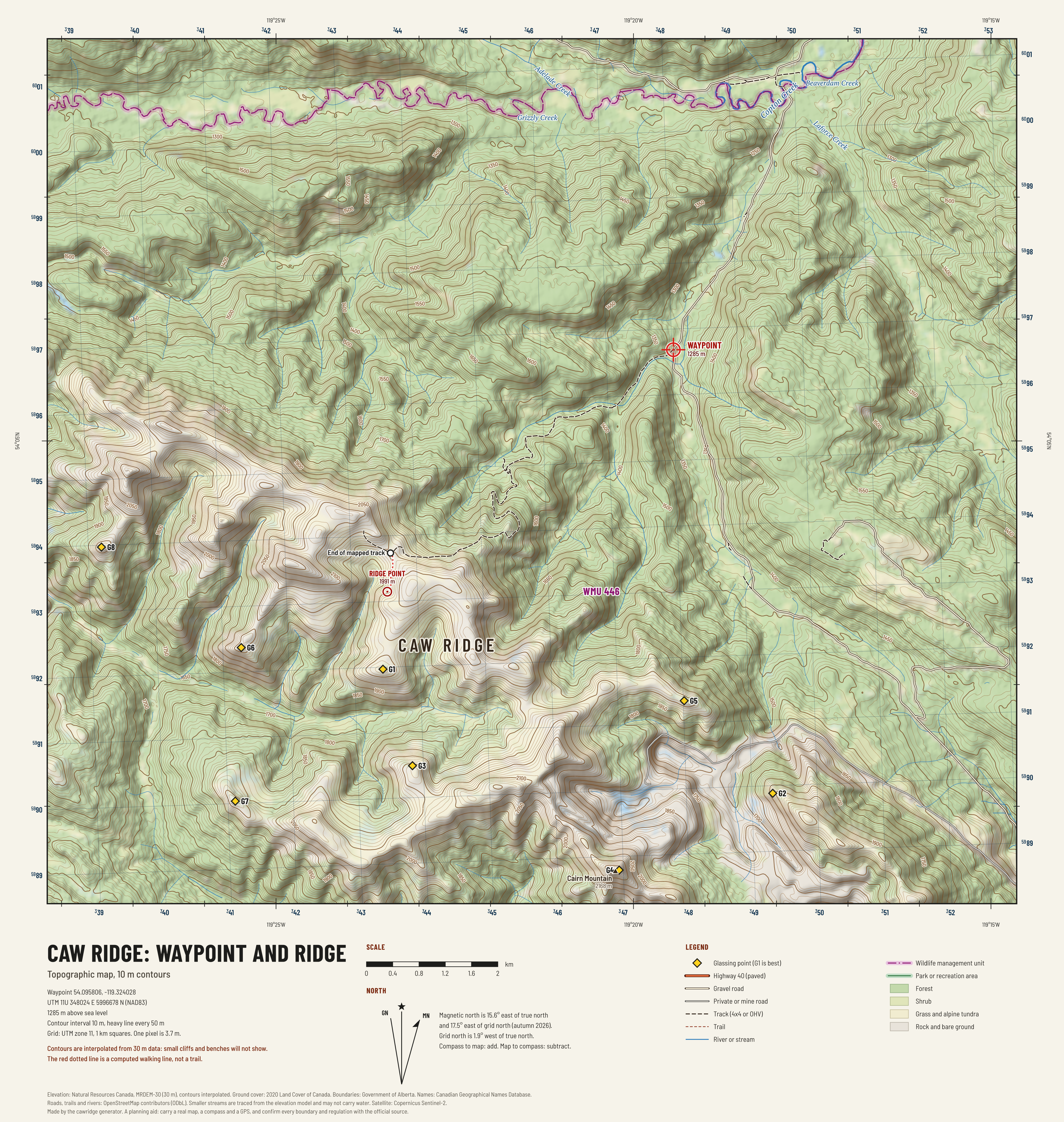
Waypoint and ridge
The waypoint in the valley, the ridge above it and the old road between them, with 10 m contours, the computed glassing points and the walking line from the end of the mapped track.
Satellite
A cloud free pass of the Sentinel-2 satellite, at 10 m to the pixel, in natural colour and in colour infrared.

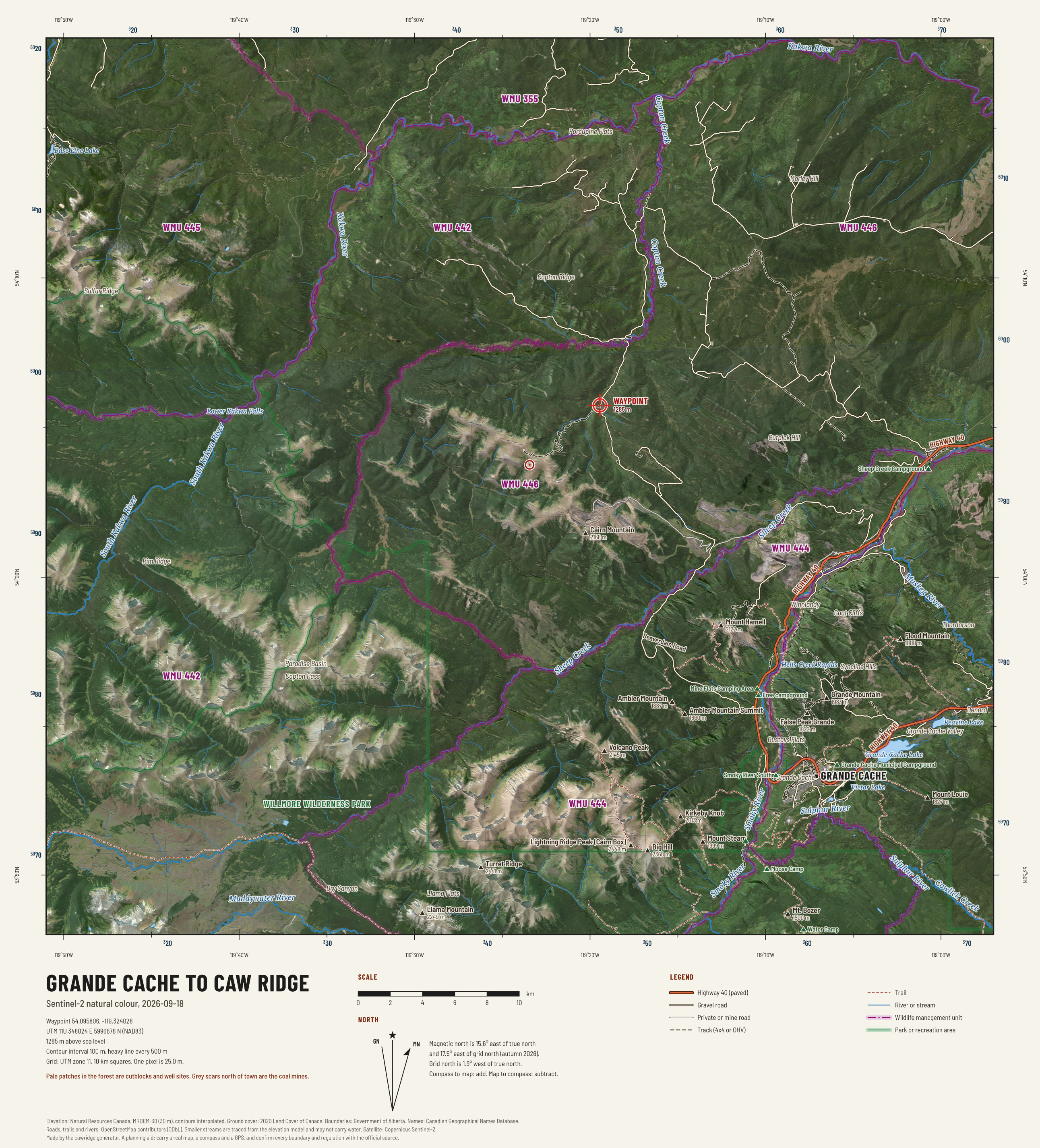
Region from space
A cloud free pass on 2026-09-18. Roads, boundaries and names drawn over the image.

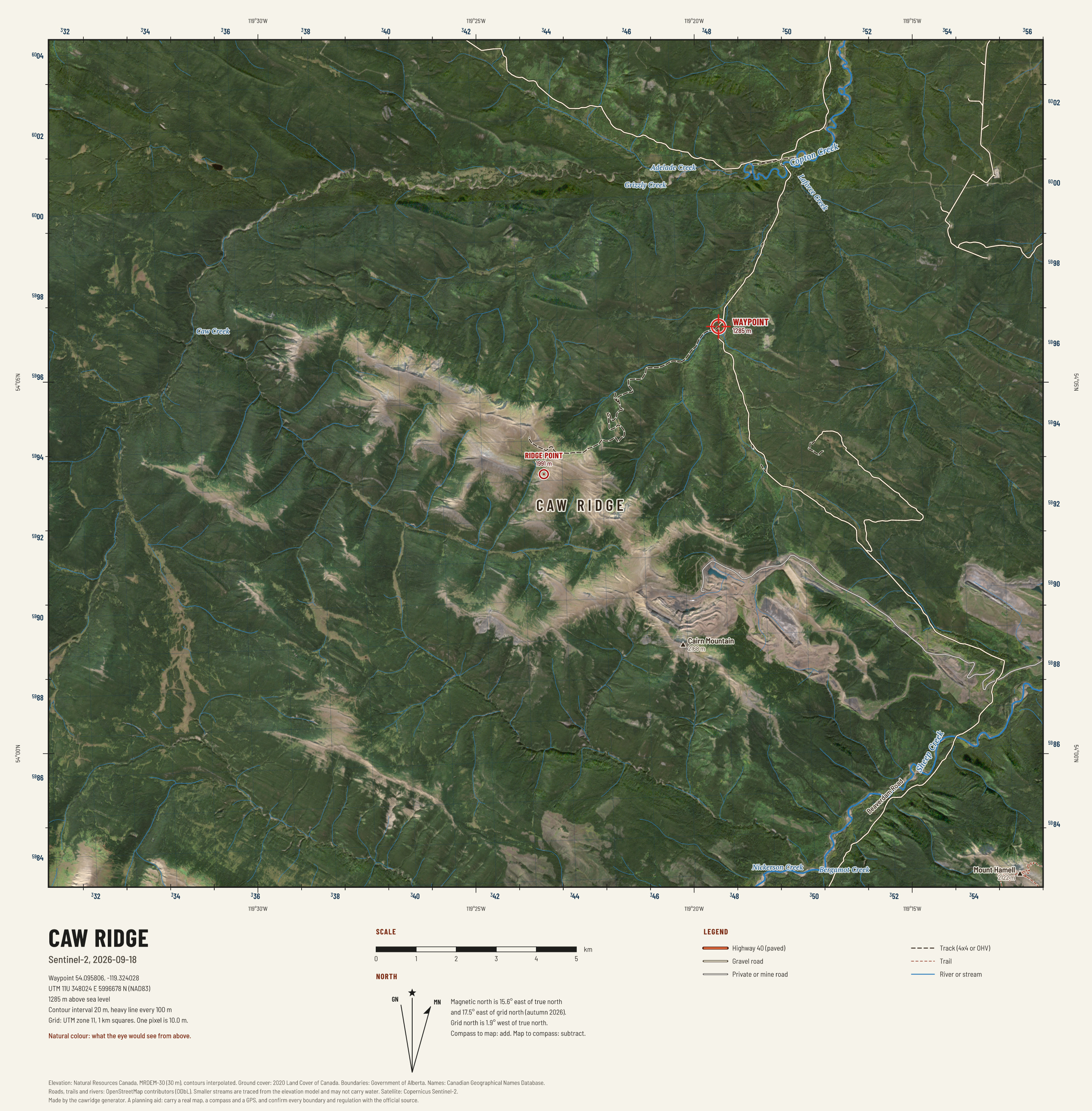
Caw Ridge from space
Natural colour at 10 m. Dark green is conifer, olive and tan is open alpine, grey is rock, scree or mine. Pass of 2026-09-18.

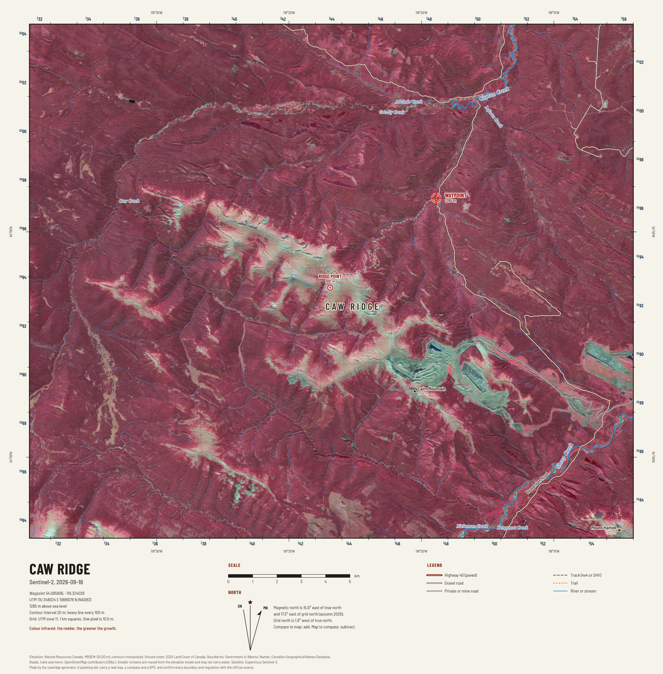
Caw Ridge in colour infrared
Near infrared shown as red. Healthy green growth is bright red, conifer is dark red, rock and cured grass are grey and tan, water is black. Pass of 2026-09-18.

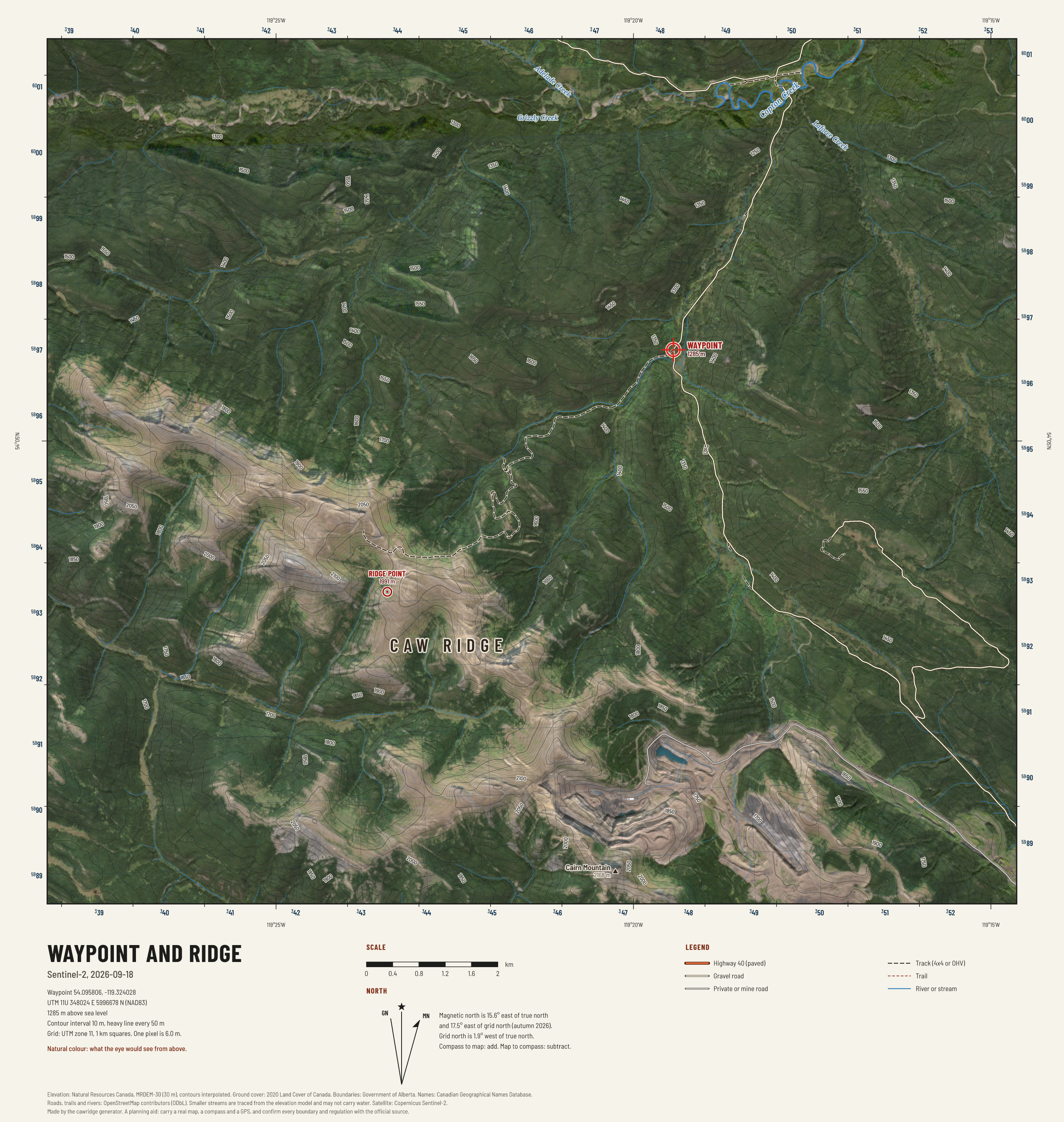
Waypoint and ridge from space
Natural colour at 10 m. Dark green is conifer, olive and tan is open alpine, grey is rock, scree or mine. Pass of 2026-09-18.

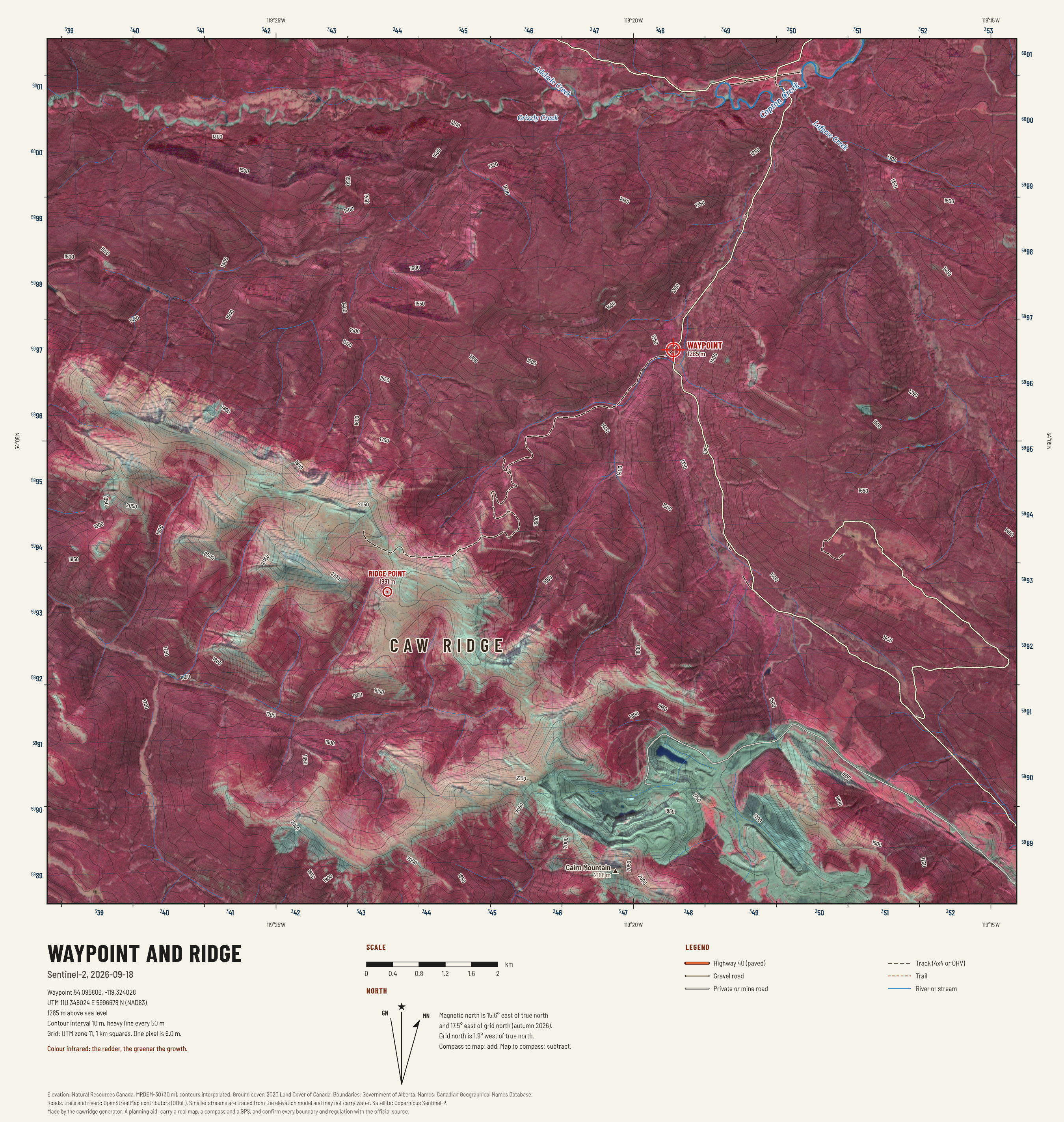
Waypoint and ridge in colour infrared
Near infrared shown as red. Healthy green growth is bright red, conifer is dark red, rock and cured grass are grey and tan, water is black. Pass of 2026-09-18.
Terrain
Height, steepness, the way slopes face, the shape of the ground, what grows on it, where the wind strikes, and how long the walking takes.

Caw Ridge: slope angle
How steep the ground is. Pale is easy, green is steady walking, yellow and orange are steep, red and purple are escape terrain.
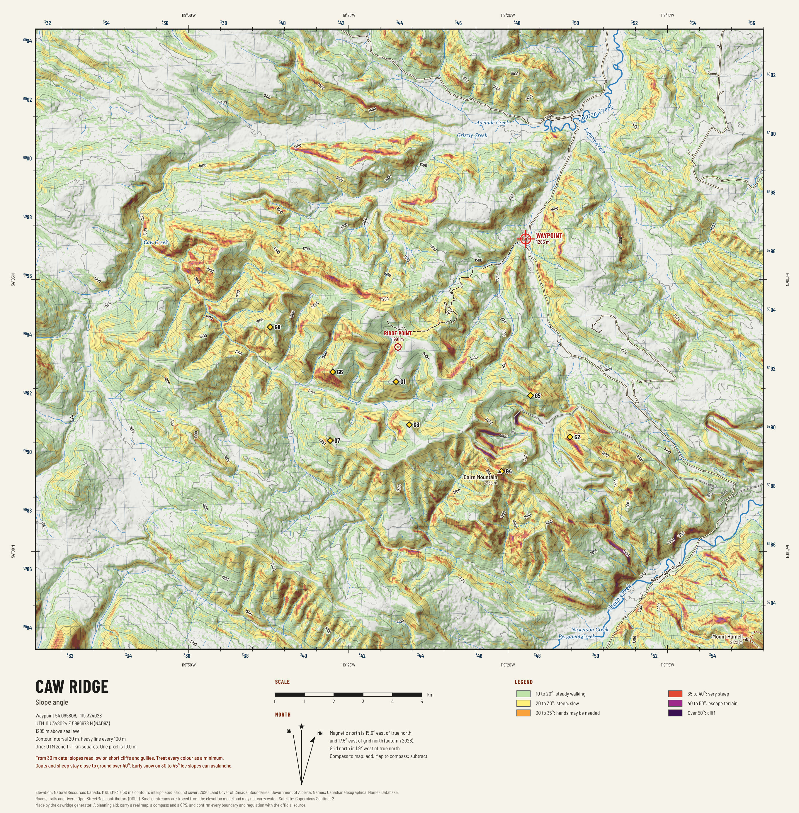

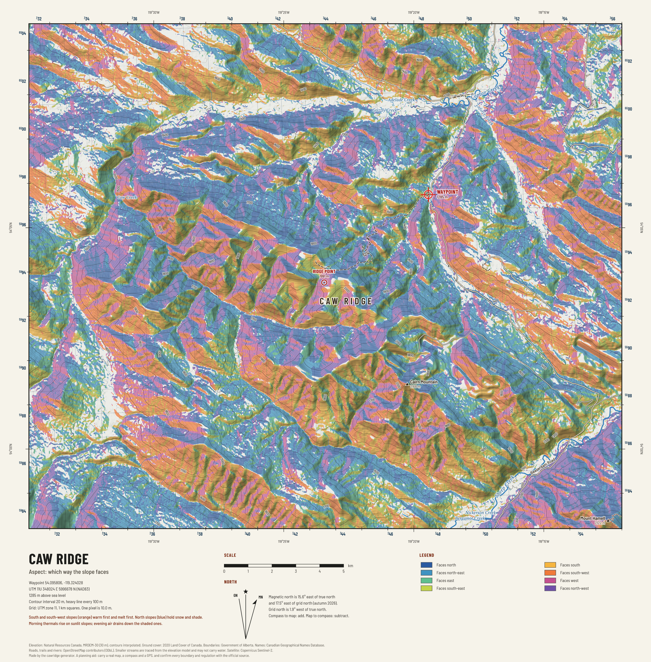
Caw Ridge: aspect
Which way each slope faces. Warm colours face the sun; cool colours face away. Use it with the wind to plan an approach.

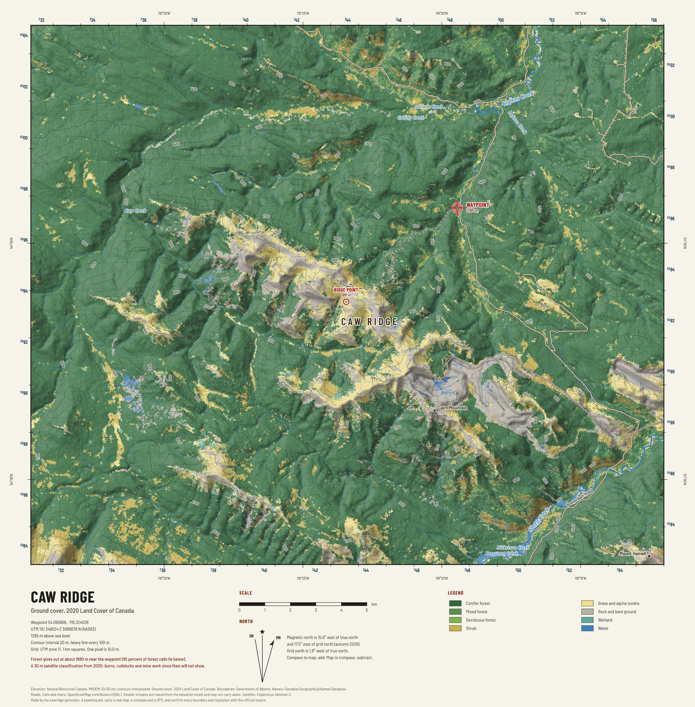
Caw Ridge: ground cover
Timber, shrub, alpine tundra and rock from the national land cover. The edges between timber and open ground are where to look at first and last light.

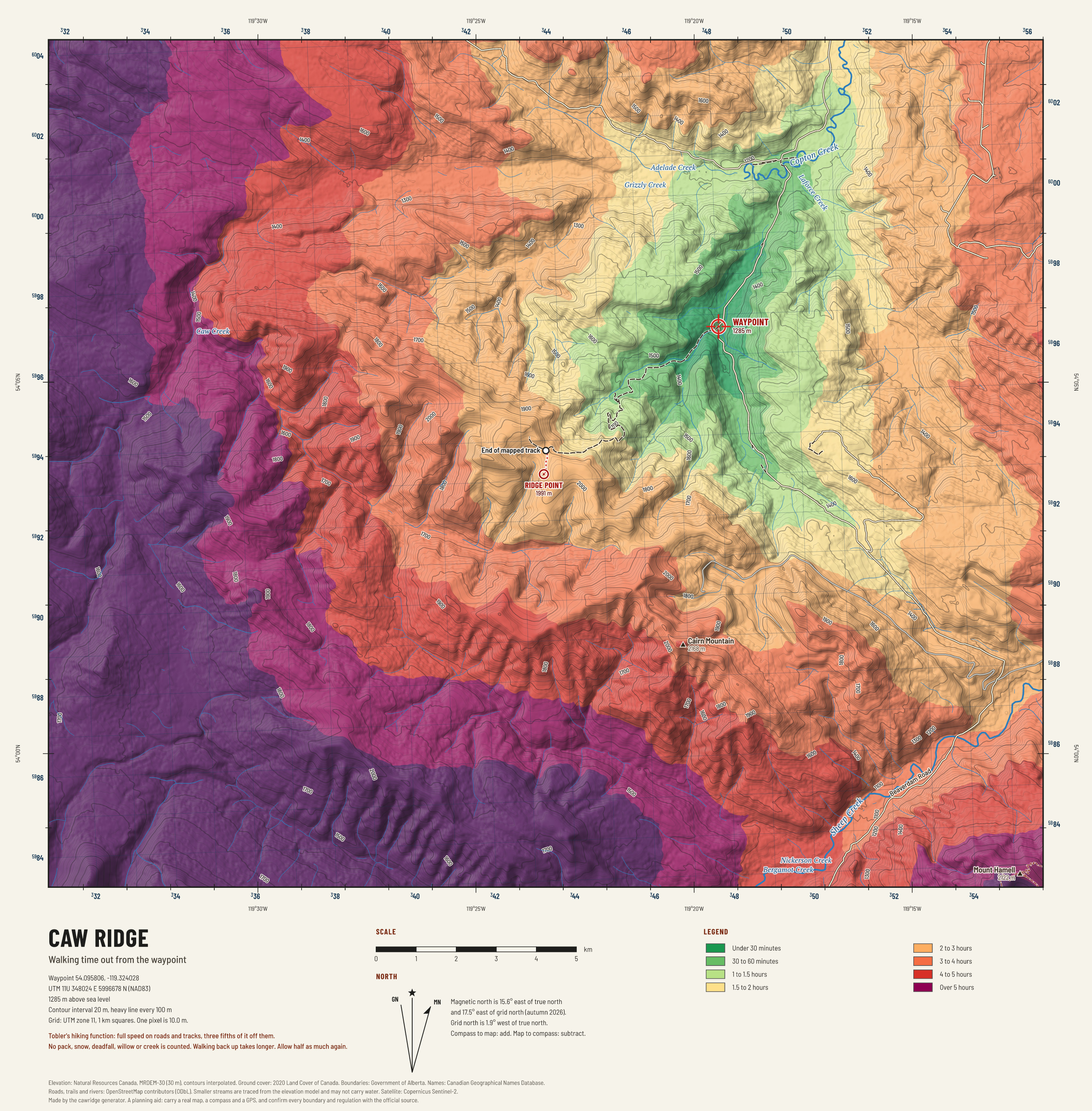
Caw Ridge: walking time
How long it takes to walk from the waypoint to anywhere on the sheet, from slope alone. Use it to judge how far a pack-out would be.

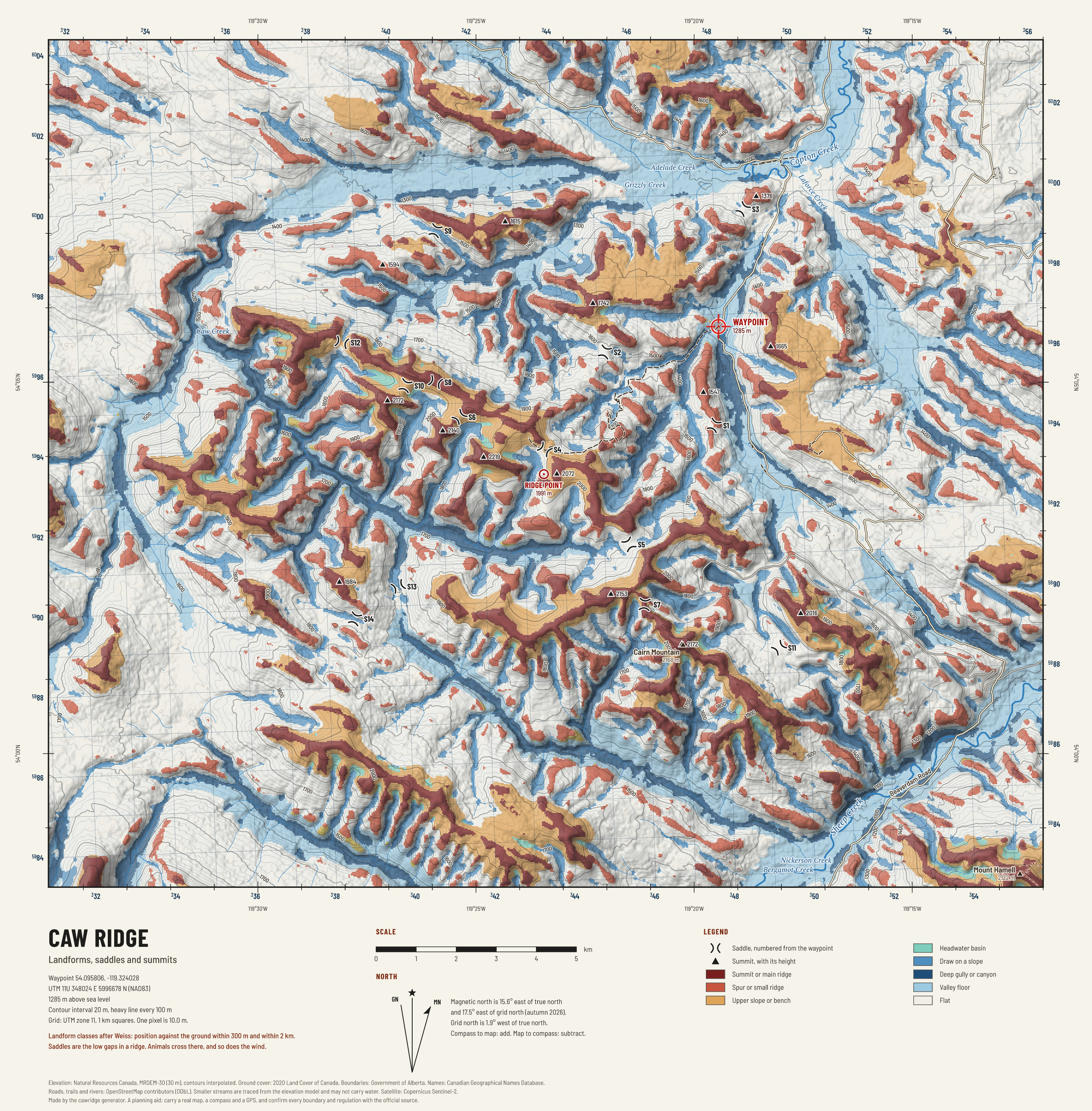
Caw Ridge: landforms and saddles
The shape of the ground sorted into crests, spurs, benches, basins, draws and gullies, with every saddle and summit marked. Saddles are where animals cross a ridge.

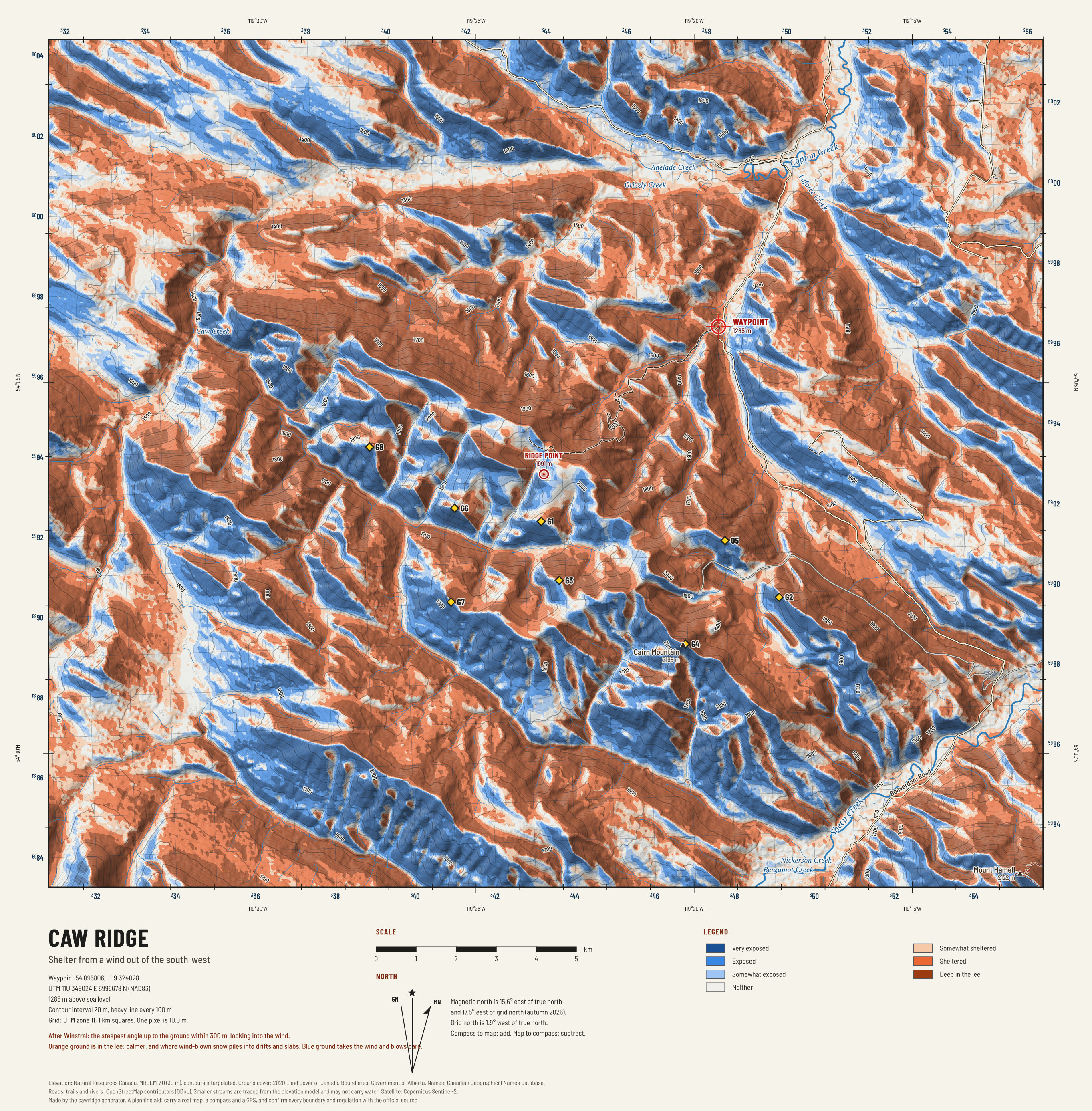
Caw Ridge: wind shelter
Where the prevailing wind strikes and where the ground gives shelter from it. Animals bed in the lee in a blow; snow drifts there too.

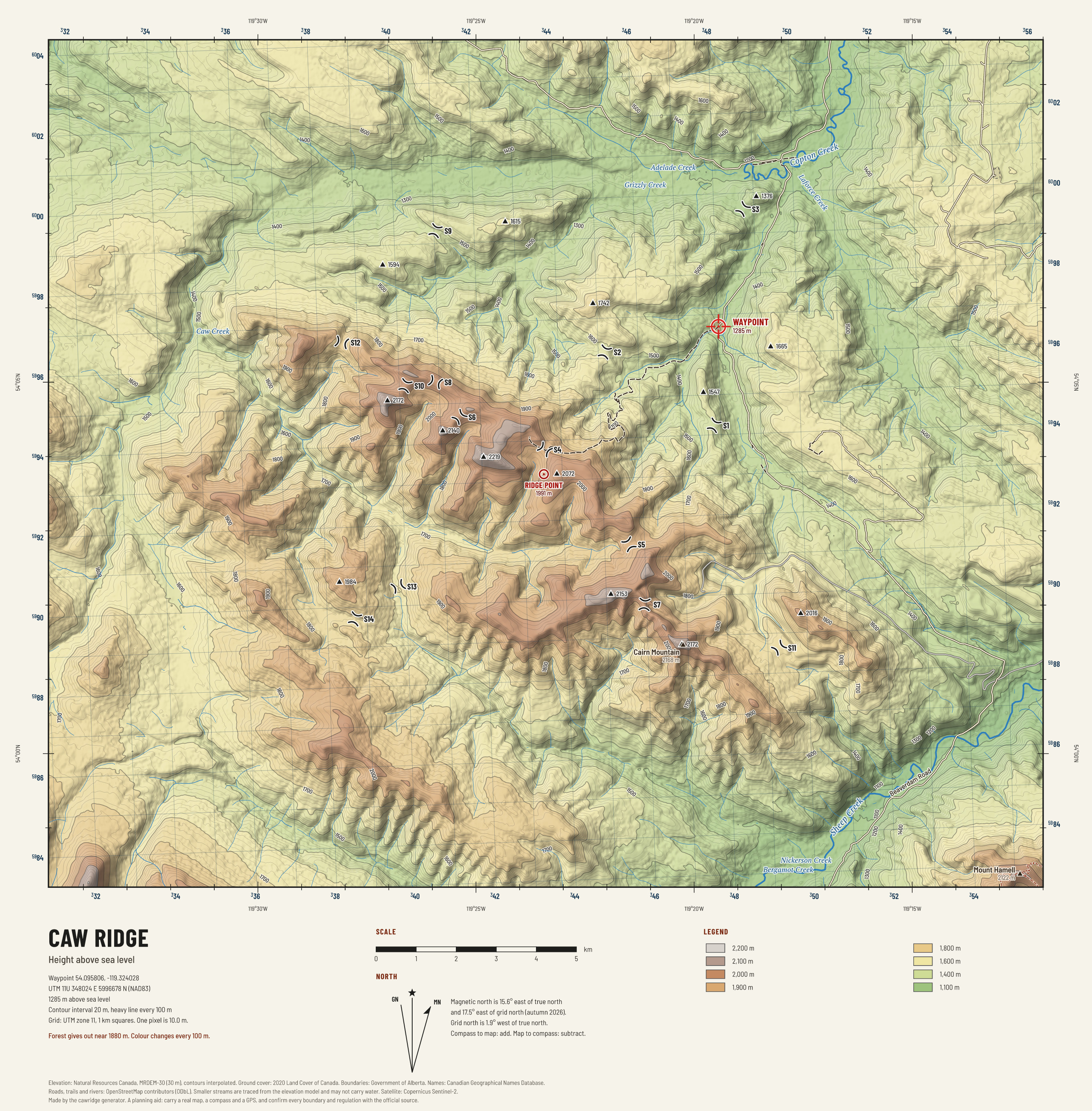
Caw Ridge: height
Height shown as bands of colour, 100 m to the band, with the summits and saddles marked. The quickest way to see what is above you and what is below.

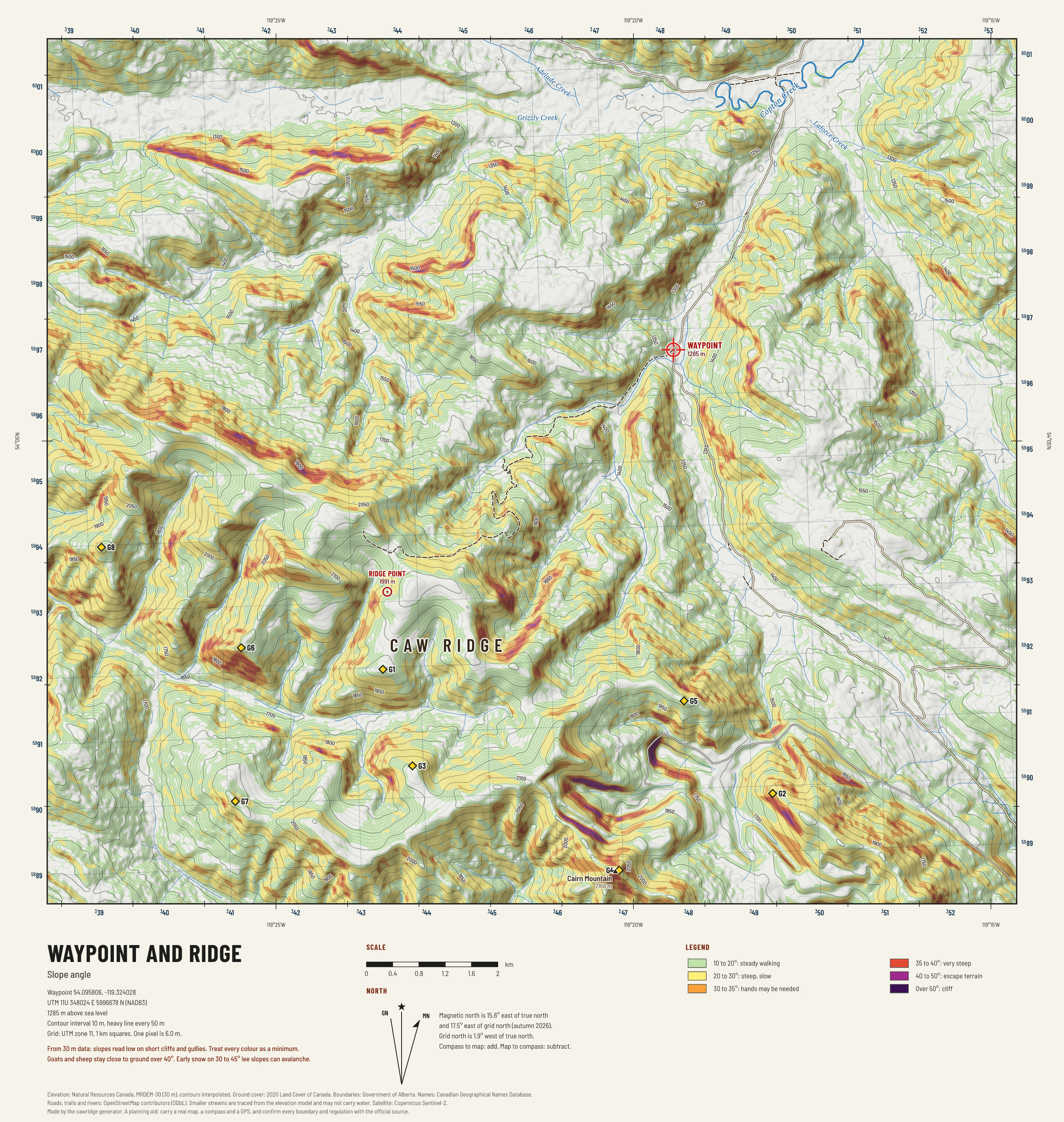
Waypoint and ridge: slope angle
How steep the ground is. Pale is easy, green is steady walking, yellow and orange are steep, red and purple are escape terrain.

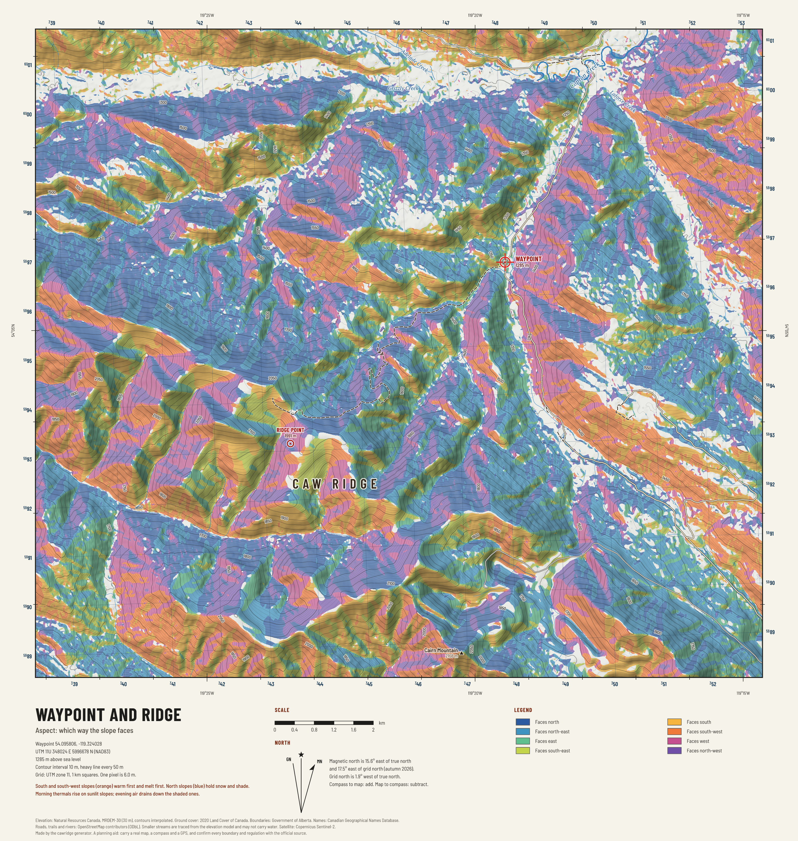
Waypoint and ridge: aspect
Which way each slope faces. Warm colours face the sun; cool colours face away. Use it with the wind to plan an approach.

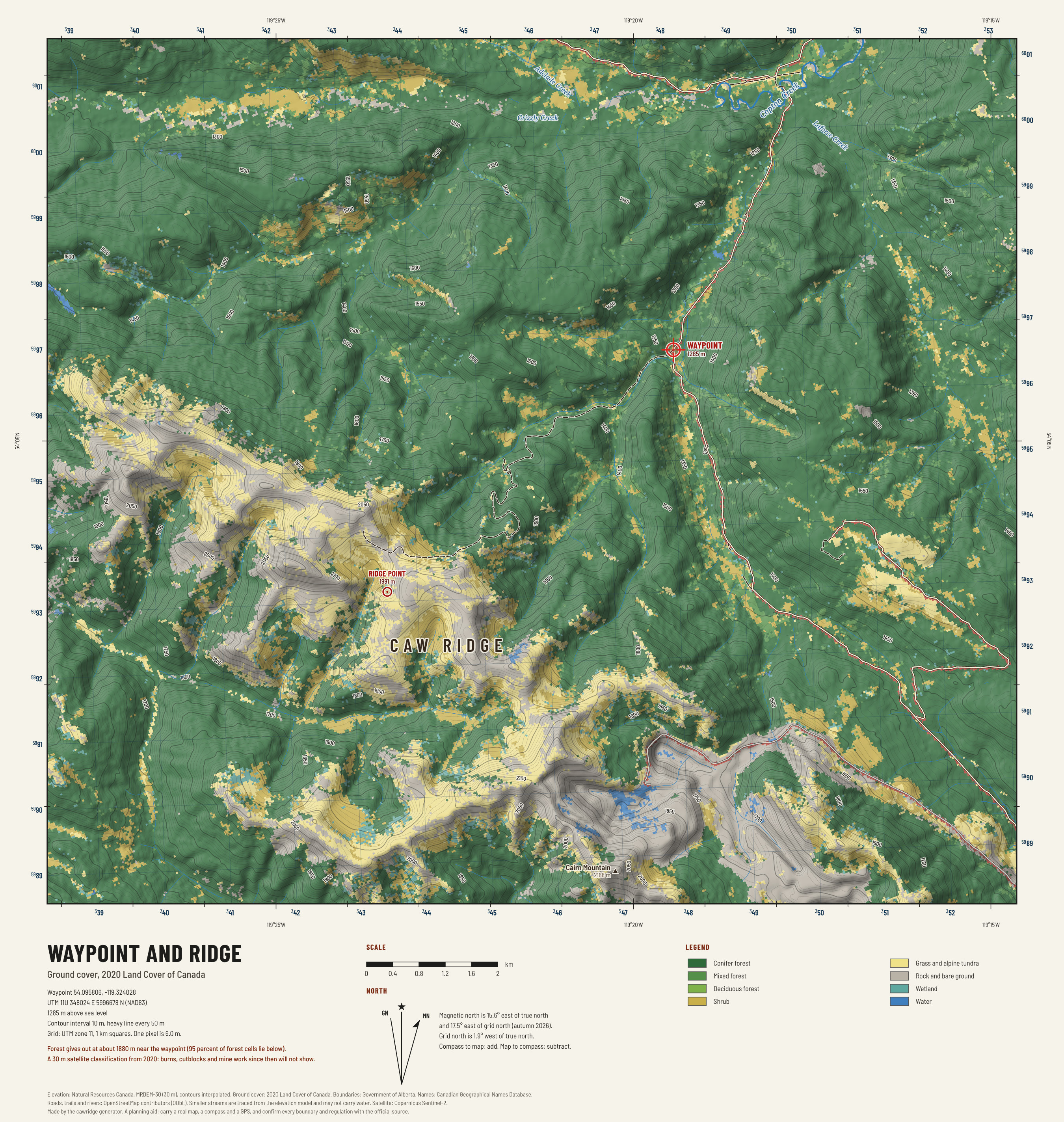
Waypoint and ridge: ground cover
Timber, shrub, alpine tundra and rock from the national land cover. The edges between timber and open ground are where to look at first and last light.

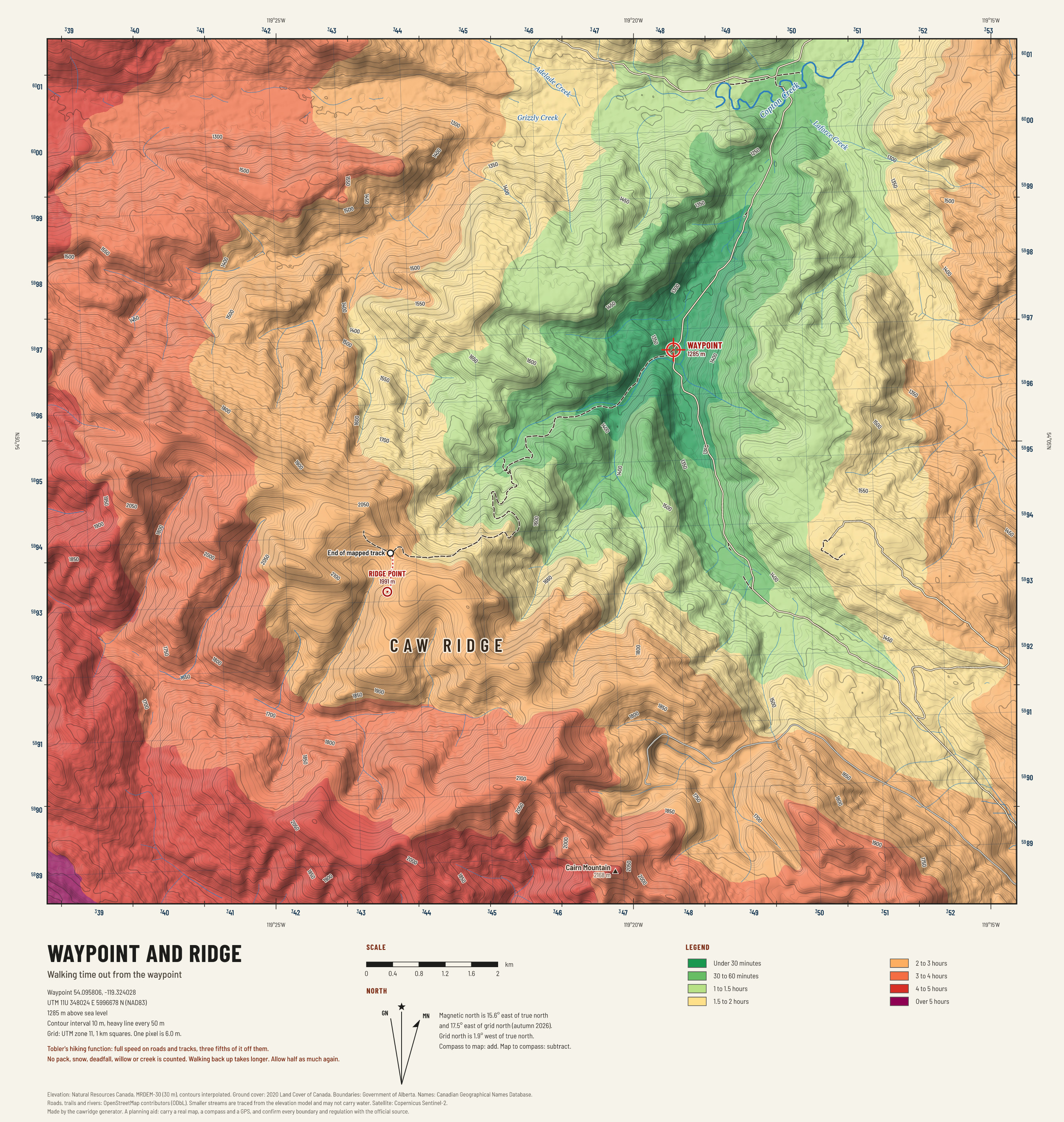
Waypoint and ridge: walking time
How long it takes to walk from the waypoint to anywhere on the sheet, from slope alone. Use it to judge how far a pack-out would be.

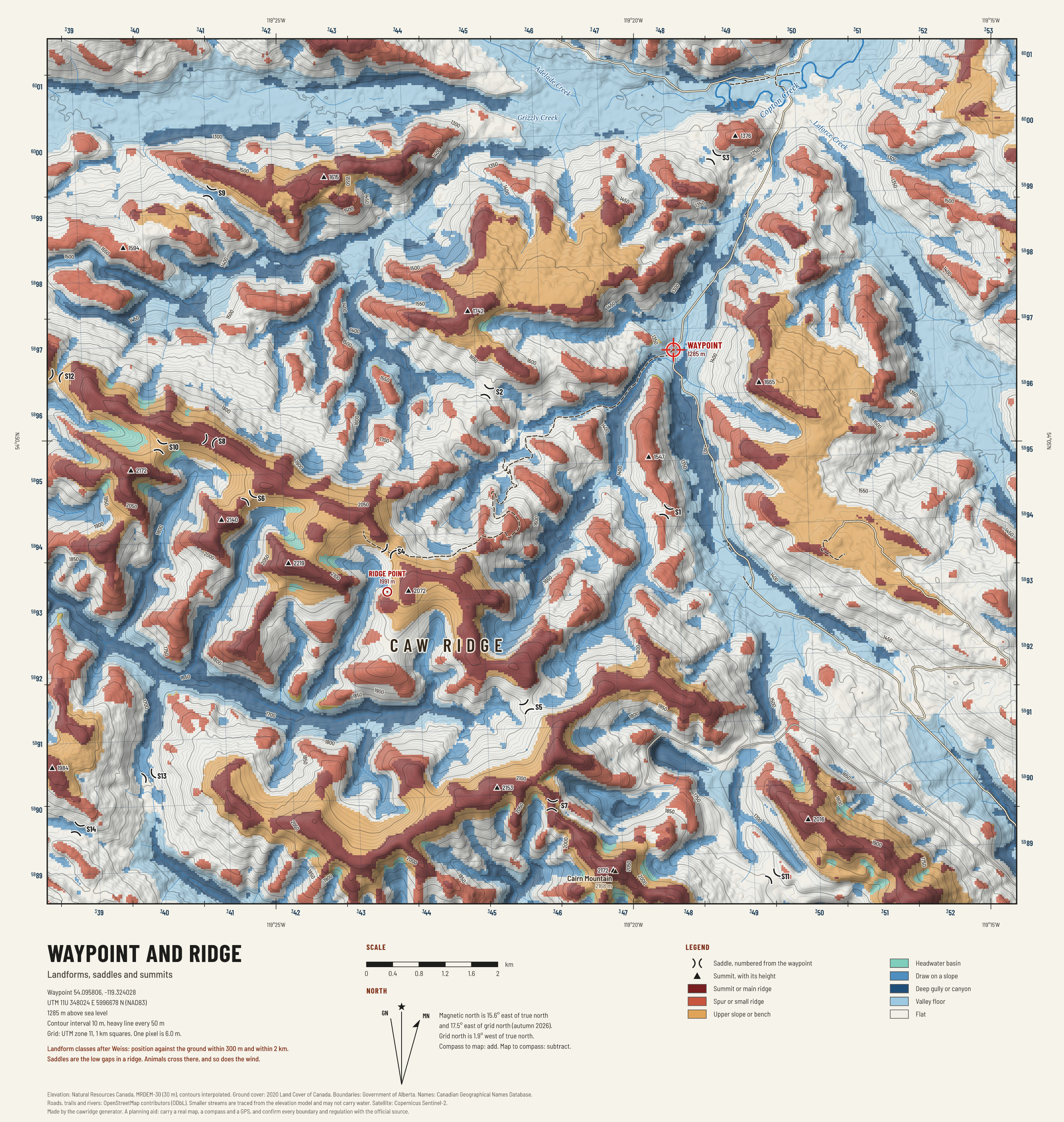
Waypoint and ridge: landforms and saddles
The shape of the ground sorted into crests, spurs, benches, basins, draws and gullies, with every saddle and summit marked. Saddles are where animals cross a ridge.

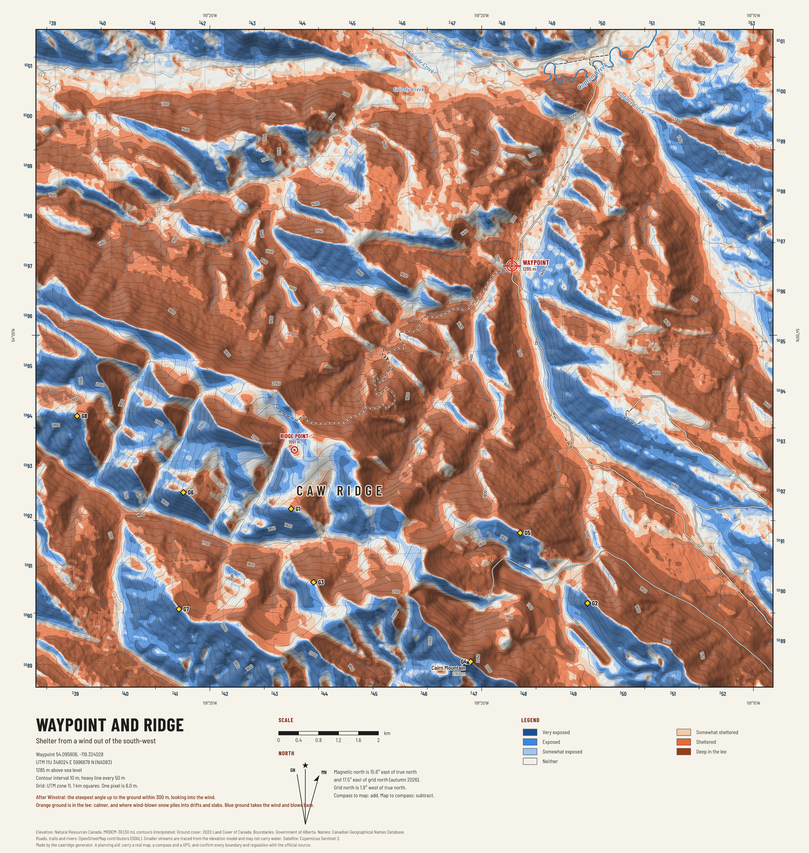
Waypoint and ridge: wind shelter
Where the prevailing wind strikes and where the ground gives shelter from it. Animals bed in the lee in a blow; snow drifts there too.

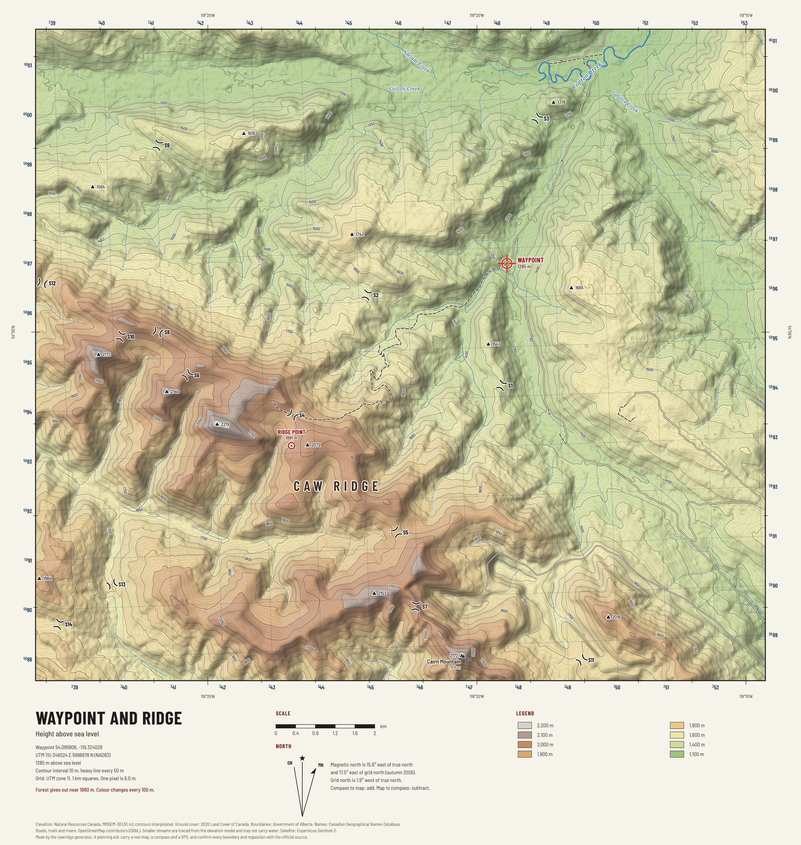
Waypoint and ridge: height
Height shown as bands of colour, 100 m to the band, with the summits and saddles marked. The quickest way to see what is above you and what is below.
Glassing
What can be seen from where. Computed sight lines from the elevation model.

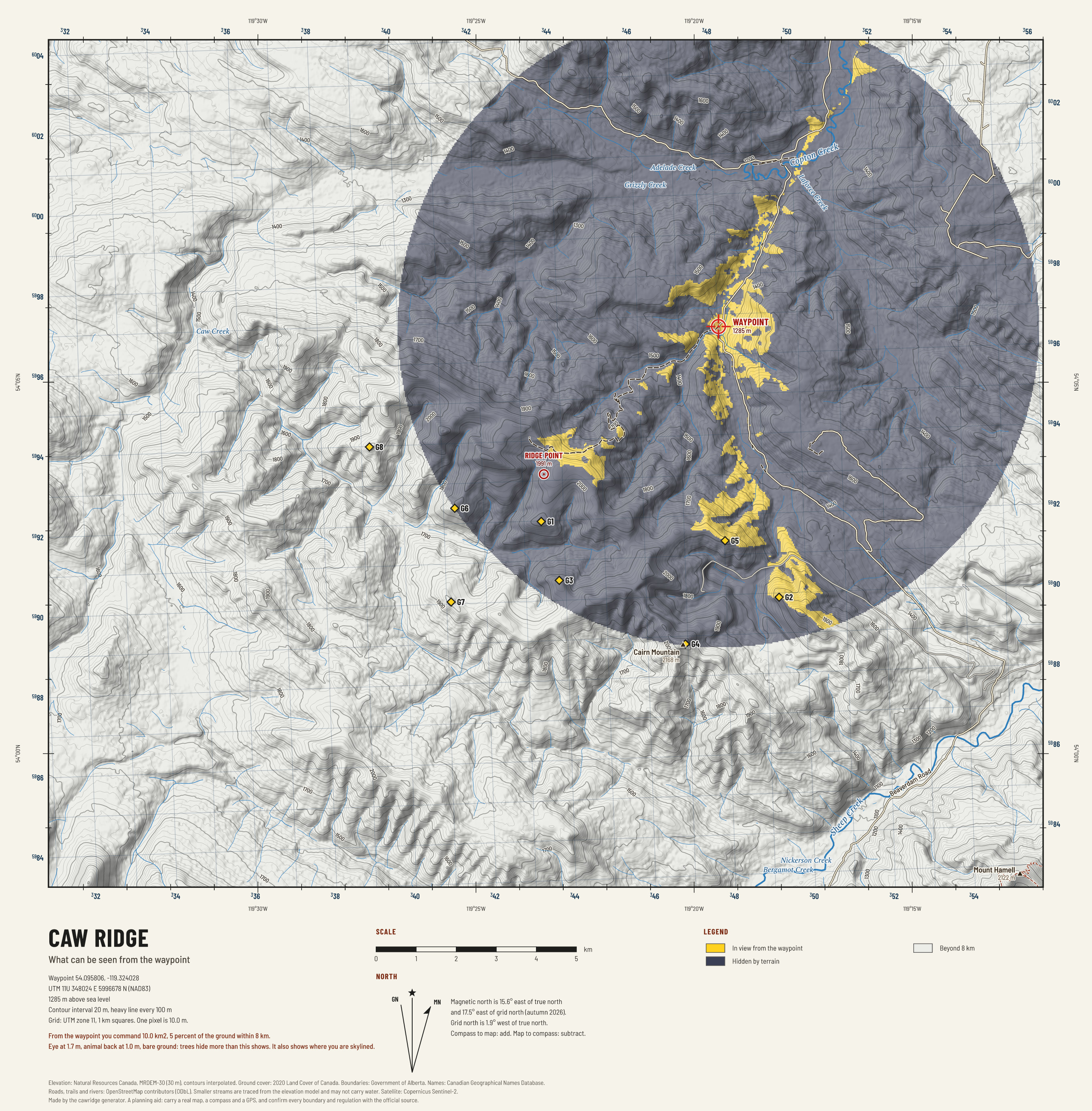
Caw Ridge: in view from the waypoint
Every piece of ground a standing person can see from the waypoint, and every piece that is hidden. What you can see can see you.

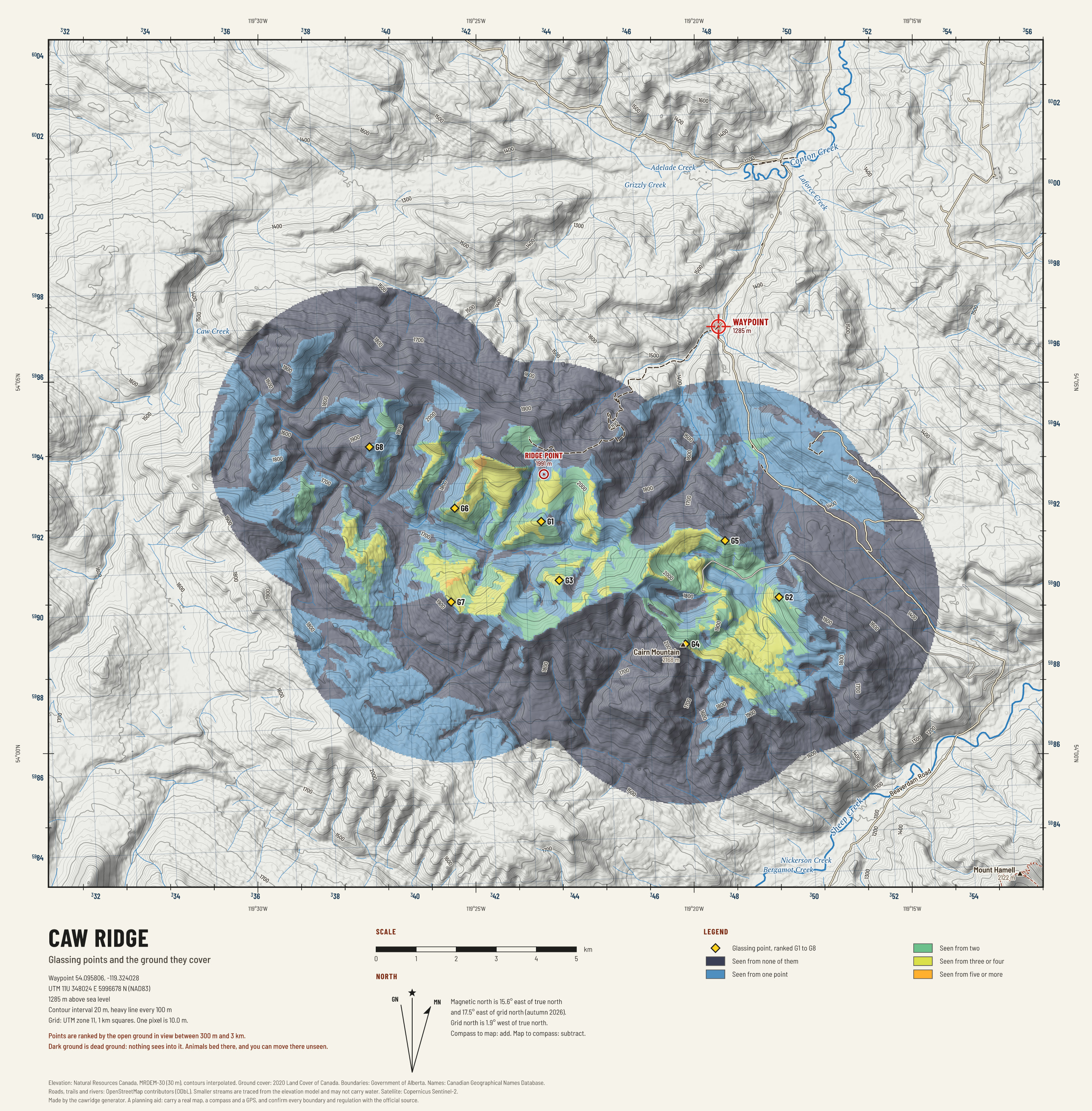
Caw Ridge: glassing points
The eight best places to sit behind glass, found by testing hundreds of spots for how much open ground each one sees, and the ground they cover between them.

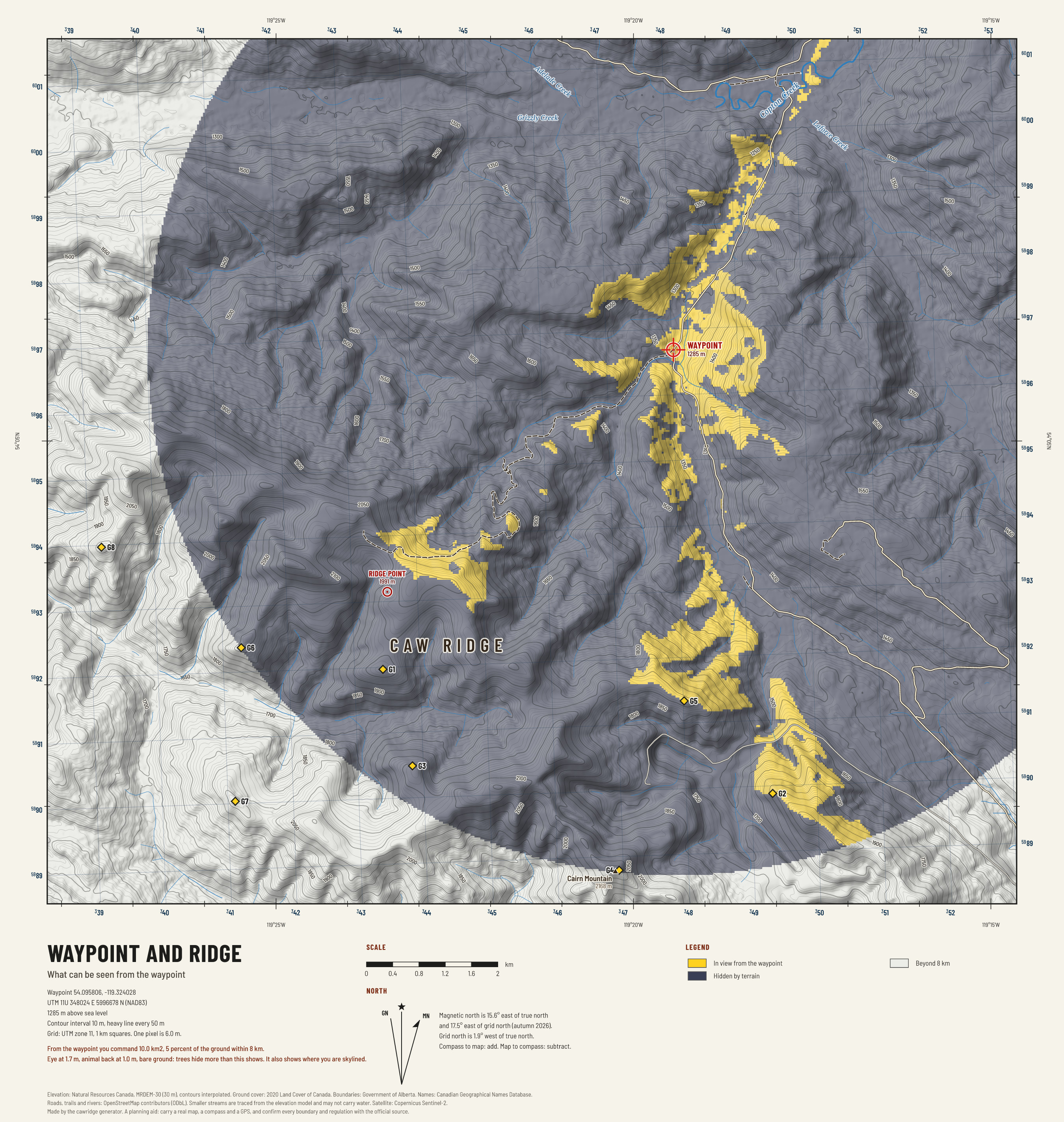
Waypoint and ridge: in view from the waypoint
Every piece of ground a standing person can see from the waypoint, and every piece that is hidden. What you can see can see you.

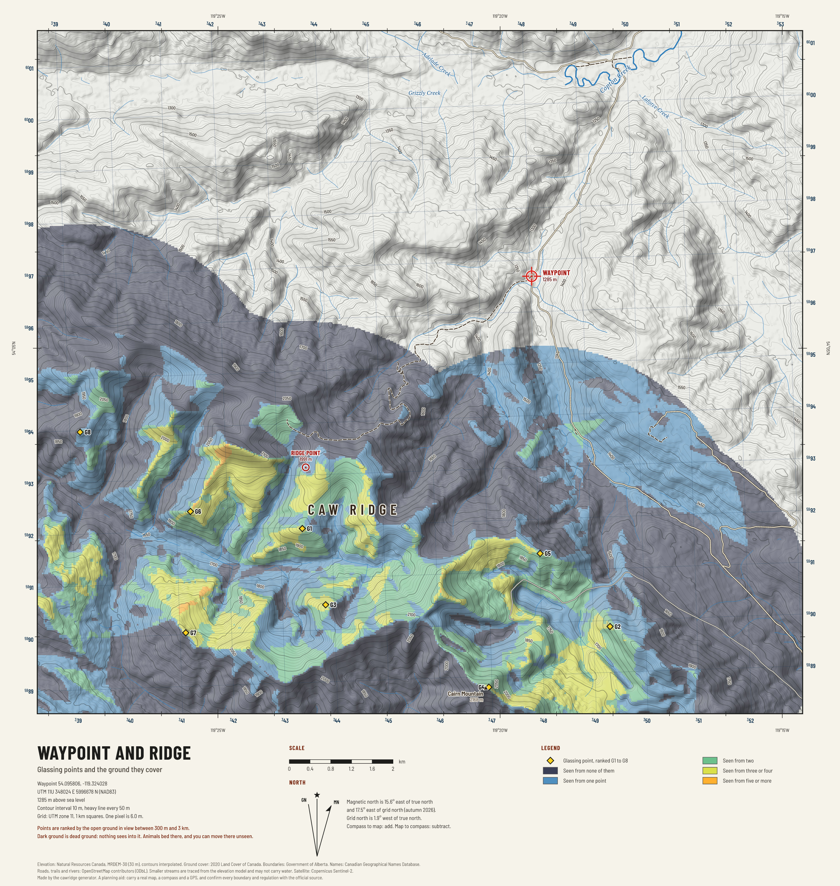
Waypoint and ridge: glassing points
The eight best places to sit behind glass, found by testing hundreds of spots for how much open ground each one sees, and the ground they cover between them.
Sun and snow
Where the morning sun lands first, how long each slope is lit, and when the snow usually comes.

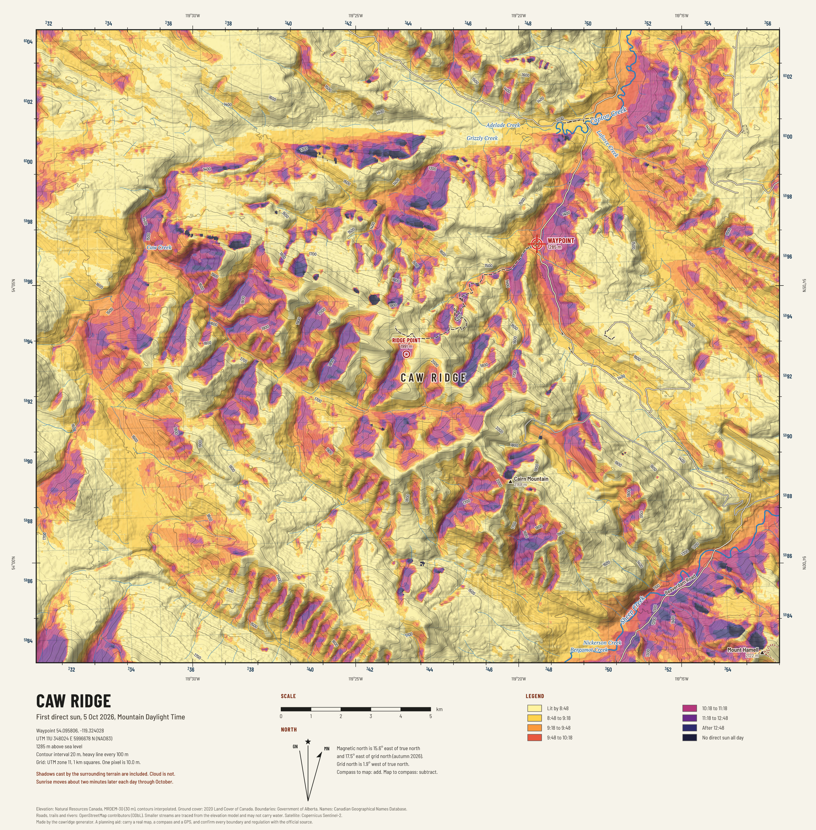
Caw Ridge: first sun
When direct sunlight first reaches each piece of ground on an early October morning, with the shadows of the surrounding ridges counted.

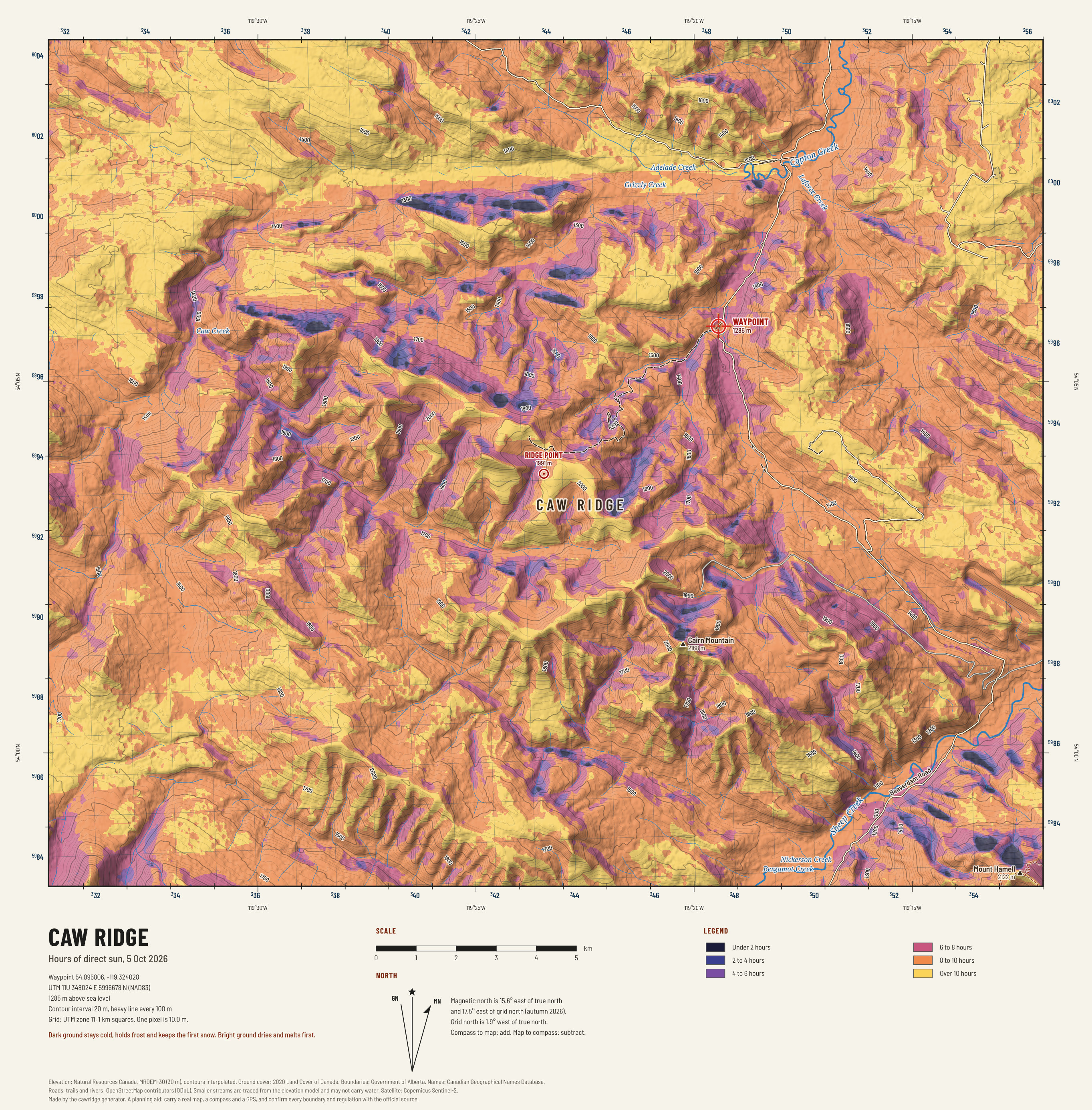
Caw Ridge: hours of sun
How many hours of direct sun each slope gets on an early October day. It shows where snow and frost linger and where the ground dries.

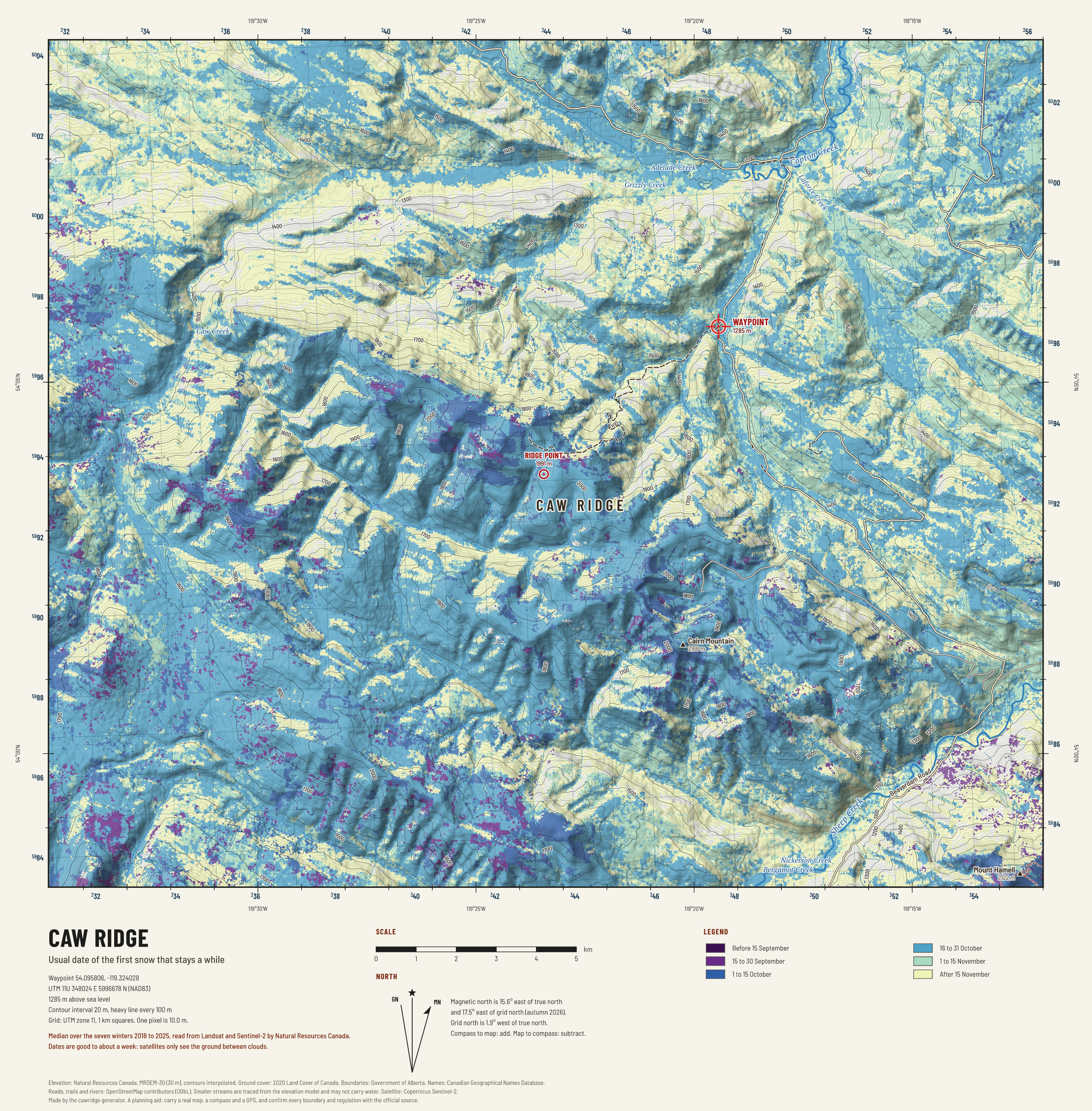
Caw Ridge: first snow
The usual start of the first snow period of the autumn, from seven winters of satellite records. The ridge top whitens weeks before the valleys.

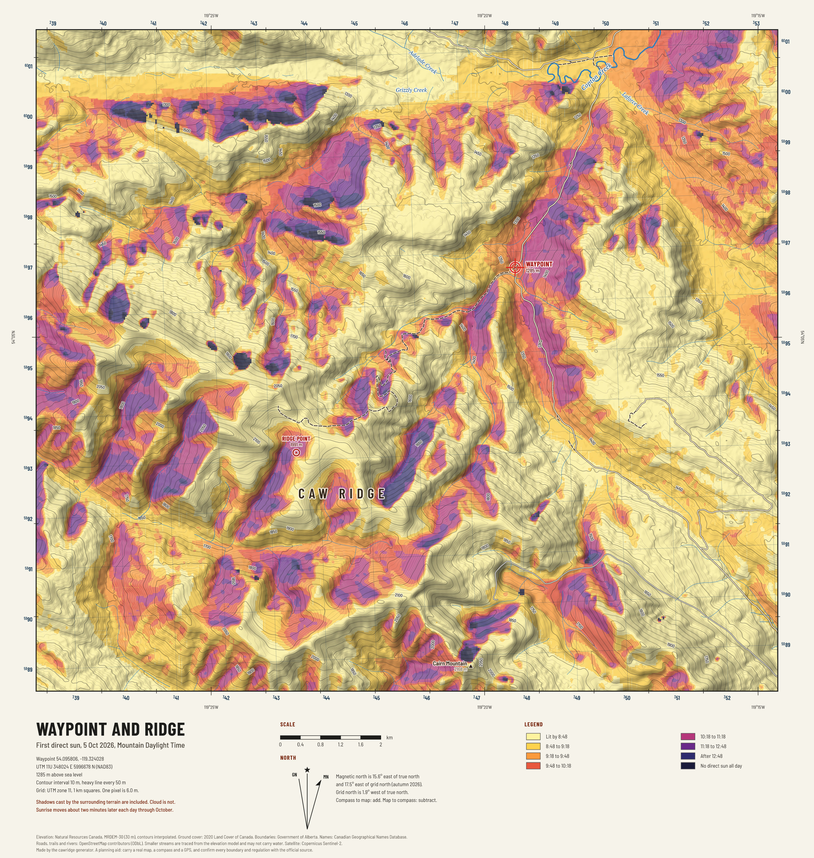
Waypoint and ridge: first sun
When direct sunlight first reaches each piece of ground on an early October morning, with the shadows of the surrounding ridges counted.

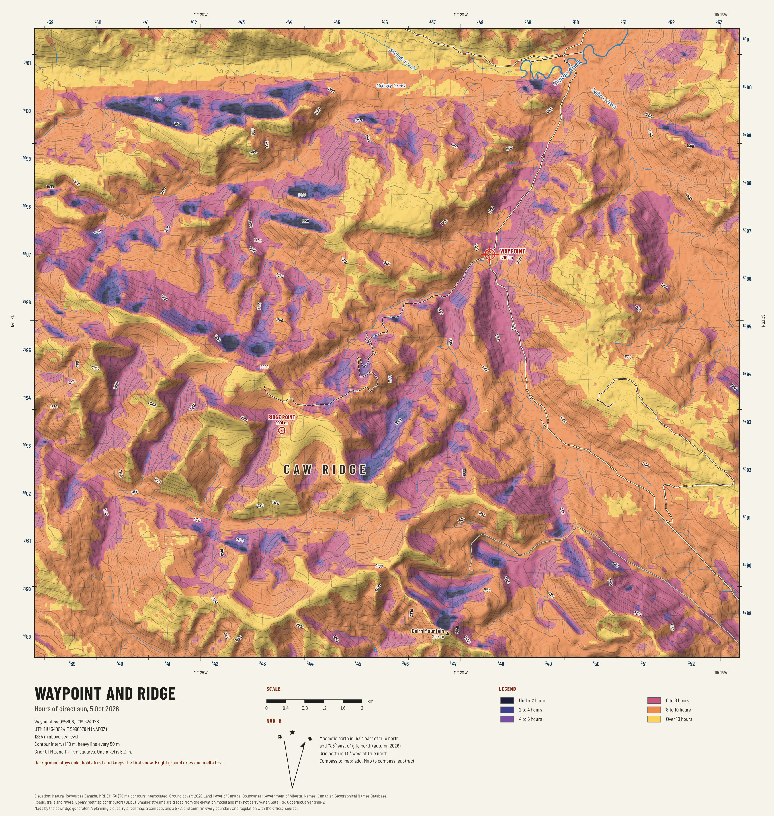
Waypoint and ridge: hours of sun
How many hours of direct sun each slope gets on an early October day. It shows where snow and frost linger and where the ground dries.

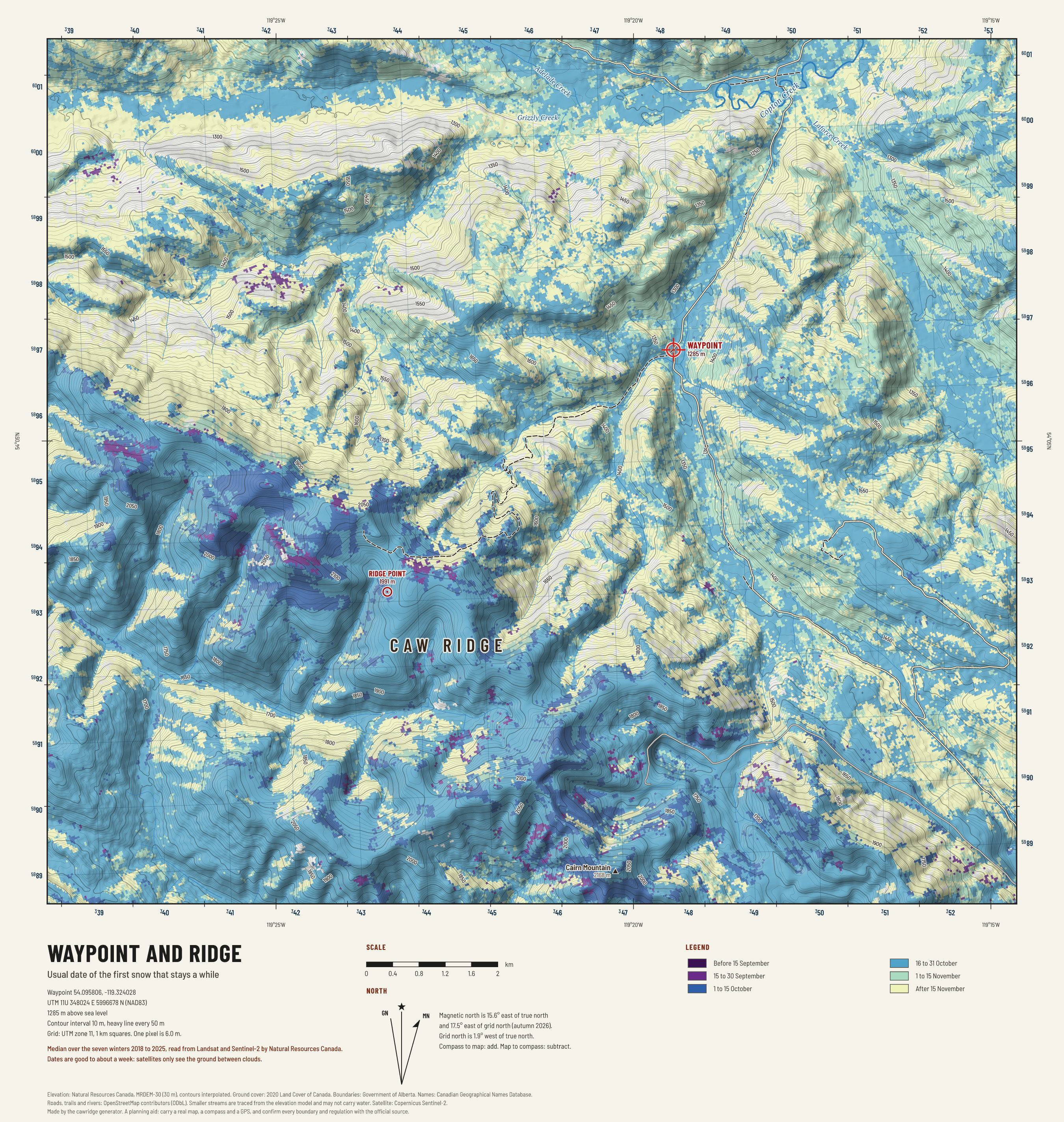
Waypoint and ridge: first snow
The usual start of the first snow period of the autumn, from seven winters of satellite records. The ridge top whitens weeks before the valleys.
Wildlife and land
Provincial wildlife ranges, and the coal leases and mine roads that shape where you may go.

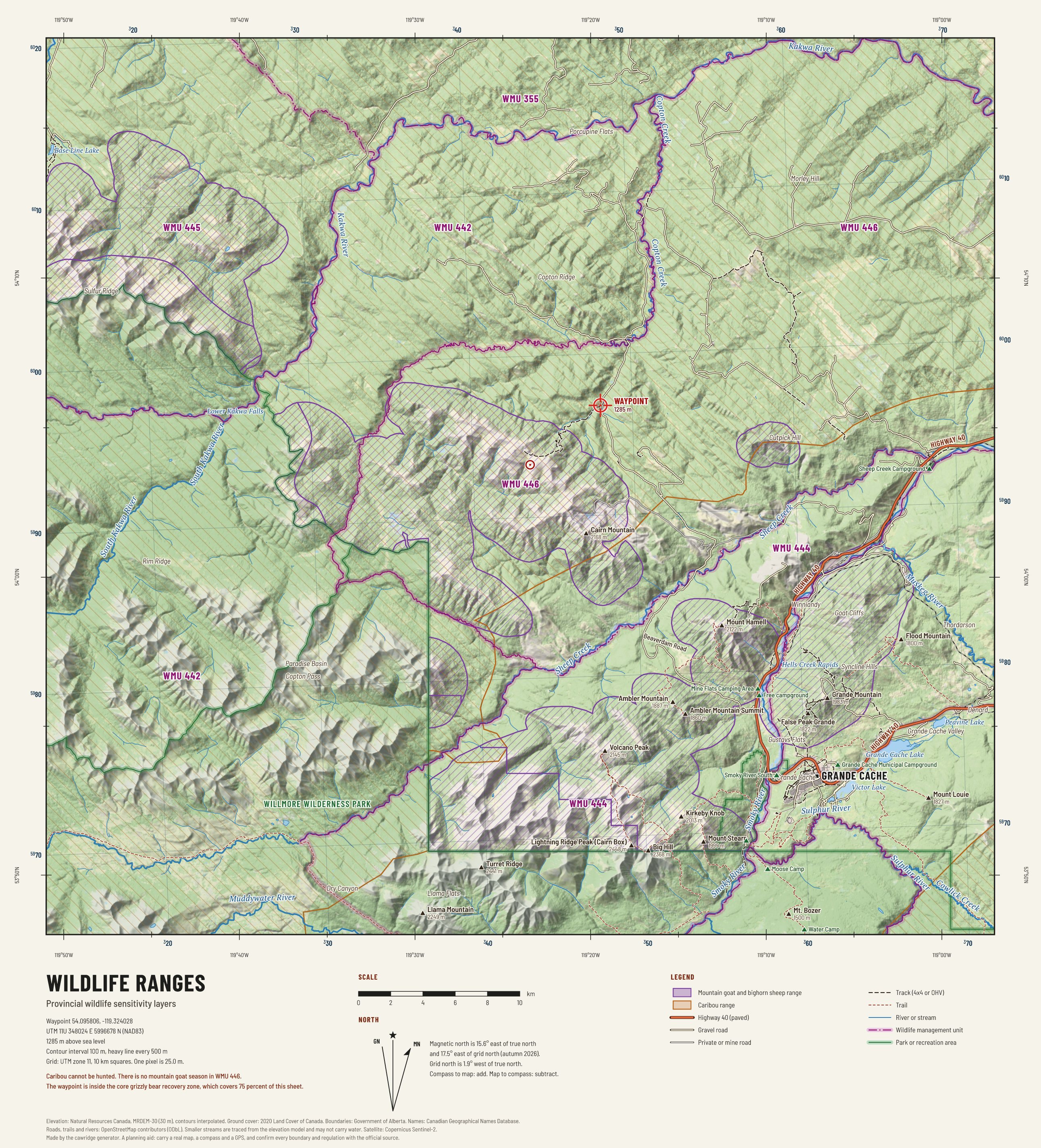
Wildlife ranges
Where the province maps mountain goat and bighorn sheep range and the caribou ranges. Hatched purple is goat and sheep ground; hatched orange is caribou range.

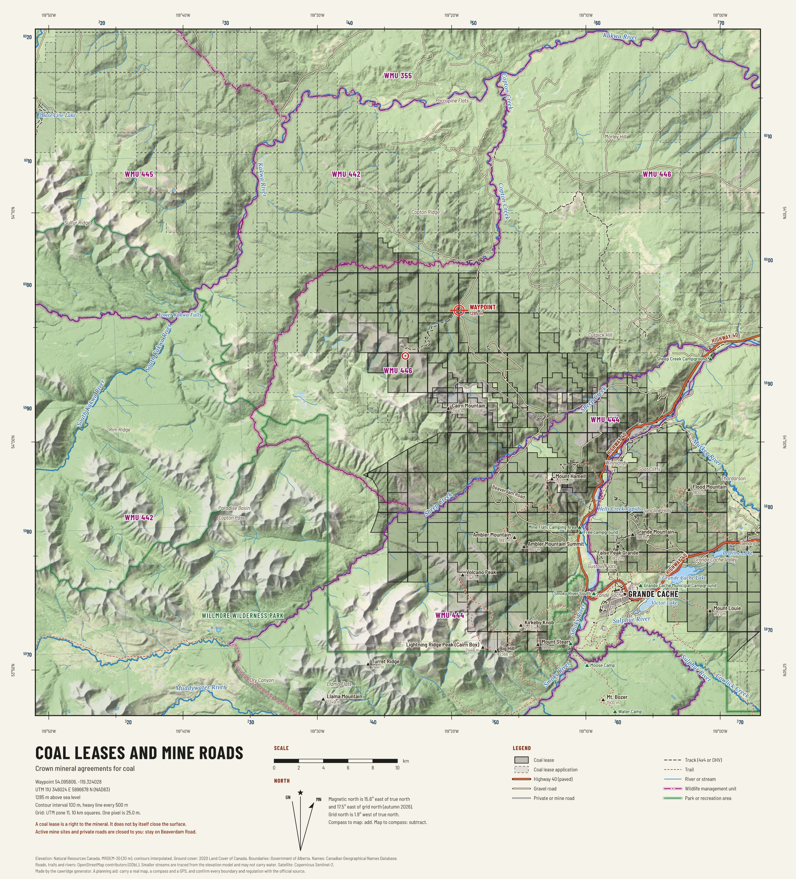
Coal leases and mine roads
The waypoint sits inside an active Crown coal lease. This sheet shows every coal agreement in the region and the mine roads you must stay off.
Files for your GPS and phone
| File | What it is | Use it in |
|---|---|---|
| cawridge.gpx | The waypoint, eight glassing points, turnoffs, camps and services; the drive as a track; the computed walking line. | Garmin and other GPS units, Gaia GPS, onX, Avenza, CalTopo. |
| ridge_topo.kmz | The ridge topographic map as a ground overlay, with the waypoints. | Google Earth, and phone apps that read KMZ overlays. |
| close_topo.kmz | The close topographic map as a ground overlay. | As above. |
| ridge_sat.kmz | The satellite image as a ground overlay. | As above. |
| close_slope.kmz | Slope angle around the waypoint as a ground overlay. | As above. |
| cawridge.kml | Waypoints and lines only. | Google Earth, Google My Maps. |
| cawridge.geojson | Waypoints and lines as GeoJSON. | QGIS, geojson.io, your own code. |
| wmu.geojson | Official wildlife management unit boundaries for the region, unchanged from the Government of Alberta. | Any GIS. |
Printing
The three topographic sheets download as PNG at full size. The ridge sheet prints well at 60 cm wide (about 1:41,000) and is still readable on letter paper. On every sheet the grid squares are 1 km, which is the quickest way to judge distance in the field.
What these maps cannot show
The elevation model has a 30 m cell. Cliffs shorter than that, narrow gullies and small benches are smoothed away, and 10 m contours on the close sheet are interpolated. Trails come from volunteers and may be missing or out of date. Small streams are traced from the shape of the land and may be dry. Nothing here is a substitute for the ground in front of you.